After five months since my first road trip, it was time for a new road trip within the Victoria state. The covid situation here is very good as when my road trip began, the Victoria state had its 28th day in a row without any new cases. It is usually remarked as the point when it can be said that the corona has been eliminated. At the time of writing this a week later, the number of days in a row is now 37. This time I chose the road trip to be four days in duration and the direction the opposite from last time, south and south-east of Melbourne. This time as the summer has started, the daytime is way longer and thus I had more time during daylight. I still of course had booked the Airbnb accommodation beforehand and pre-selected some places to visit, but at least it left more possibilities for ad-hoc changes.
Day 1
Like last time, I went to pick up the car on Friday morning. This time they asked me that is it ok to have manual transmission in the car. Without hesitation I said no, as still changing gears with the left hand didn’t tempt me. This time I got a Toyota Yaris, which also had the lights and windscreen wiper controls the opposite way I have used to.
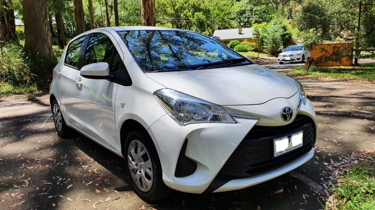
My ride this time
For the first location I had chosen the 1000 Steps in Dandenong Ranges National Park, which is said to be most popular bushwalks of Melbourne. As the name implies, it’s a steep uphill hike. It would have been nice place to start the trip, but as I already had been following the status of the place, it wasn’t open that day. It’s still closed today as it has been for weeks. They are improving the paths there to be more covid safe as it’s very popular place. Also, one nearby trail that I had as a backup was closed, so I selected another car park in the same national park and had about 2,5km walk there.
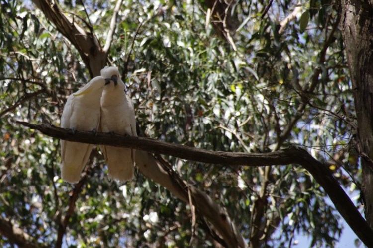
Couple of sulphur-crested cockatoos 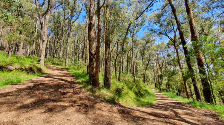
Trail at Dandenong Ranges National Park
After a lunch nearby, the next target in my itinerary was Moonlit Sanctuary Wildlife Conservation Park. As I was driving there, the temperature had reached over 30 degrees Celsius, so it was going to be a hot park visit. I had to buy tickets before hand to a certain time so they can distribute the incoming masses to the park during the day. I had bought the 3pm time for entry but I arrived there 30 minutes before hand. After seeing that the parking lot was almost empty, I figured that they might let me in early. It was good to have those times with ticket as I think I saw couple of families in addition to me. So, I basically had almost the whole park to myself. However, as the temperature was over 30, in addition to not having visitors there, also the animals weren’t the most active. With the ticket I also bought small feeding jar that can be used to feed the free roaming kangaroos and wallabies. Most of them were just resting in the shade but one kangaroo and couple of wallabies came to eat the animal food I had. Only one of the koalas were moving around in their pens. There were also lots of different birds, but seeing exotic birds is quite everyday event here.
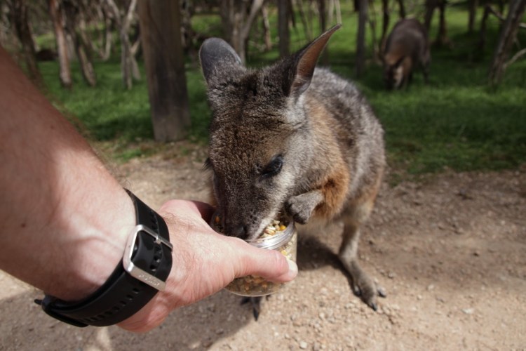
Feeding wallaby at Moonlit Sanctuary 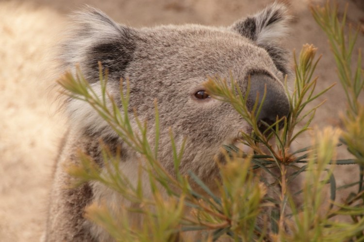
The only koala awake in the 30°C heat
Originally, I had planned to go see penguins arriving to their nests during sunset in Philip Island, but that attraction already was fully booked when I tried to buy the tickets. My accommodation was still there in the Philip Island close to a surf beach in a small town of Cape Woolamai. When I arrived at the Airbnb place and chatted with the host for a while, I headed to the surf beach. I could hear the beach long before seeing it as it had this constant roar of waves. And the waves were quite big when I got there so no wonder there were plenty of surfers. As it was a low tide, I walked along the beach in hard sand for about 1,5 km. When I got back to the centre of the small town to look a place to eat, I learned that all the restaurants were closed already after 8pm. Luckily, I wasn’t too hungry and just enjoyed some nuts with couple of beers back in my accommodation. That Airbnb place was quite ecological as all the electricity was from solar panels and the water was from tanks filled by rainwater. As there were no air conditioning, the windows in my room were open and because of that, my wake up was a lot of exotic and loud bird singing.
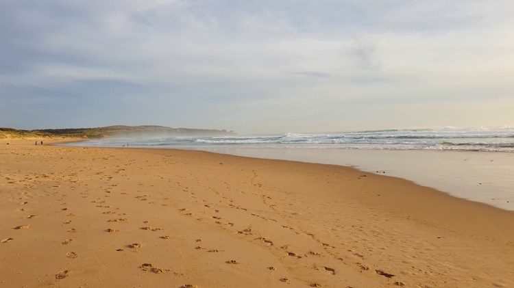
Woolamai Surf Beach 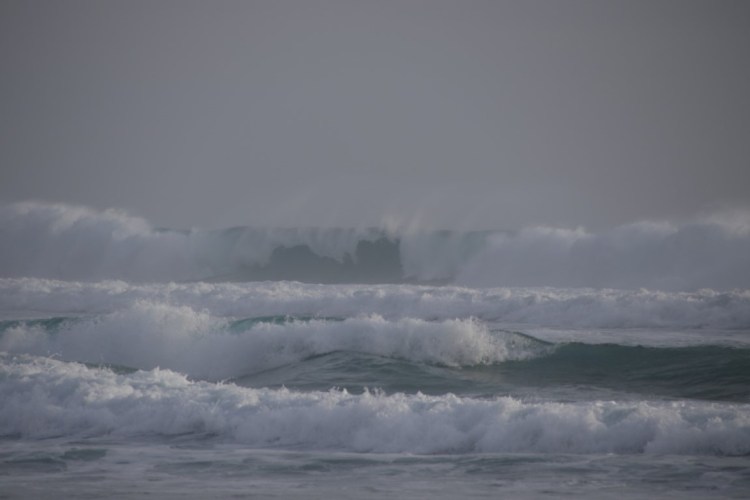
Some nice surf waves at the beach
Day 2
The next day began with two-hour drive to Wilsons Promontory Marine Park, which is the southern most place in the mainland of Australia. From there I had prechosen two interesting locations to visit. First was Mount Bishop that had 3,4 km hike there and back with vertical climb of 278 metres. The temperature gladly was much lower in comparison to the first day and of course now I was close to the coast that usually has cooler weather. It was a nice walk in the forest with nice views and some rainforest elements with big ferns. The marks of a great bushfire in 2009 were still visible in the trees as there were lots of black-scarred bark with otherwise living trees. It shows well that the trees that grow here withstand the occasional fires as natural phenomenon.
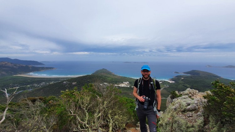
On top of Mount Bishop 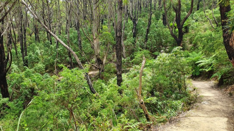
Trail climbing to Mount Bishop
After walking back to the car, I drove to the next interesting location of Big Drift. It’s a place of vast area of inland sand dunes, which reach above the forest and farmland. To get there it was about 2km walk along a bit farmland and ended up with very steep climb in the fine-grained sand, which took some effort to get on top of the dunes. In the end it was worth it to get there as it was quite absurd that from middle of forest and bushes suddenly there is a huge sand dune ten meters higher than the path that took there. I walked on top of the dunes about 800 metres and I only covered a fraction of the whole area as seen in the image of satellite map with tracking data.
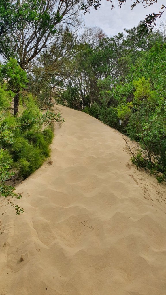
Steep climb to the Big Drift in fine sand 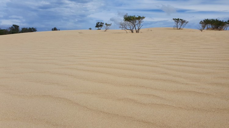
The harsh looking scene at Big Drift 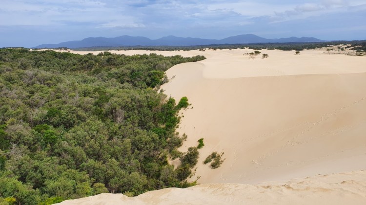
Over 10 metres high sand dunes in the middle of forest 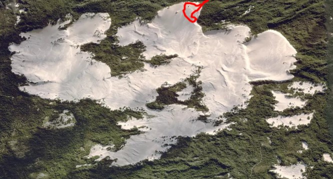
Big Drift from satellite view. Photo from Strava showing my 800 metres walk on top of the dunes.
Then I had only about an hour-long drive to my next accommodation in a small coastal town of Port Albert. After accumulating 19347 steps and 12,85 km of walking that day, I didn’t have the energy anymore to see the small town further. It was also a bit drizzling so that also helped that decision.
Day 3
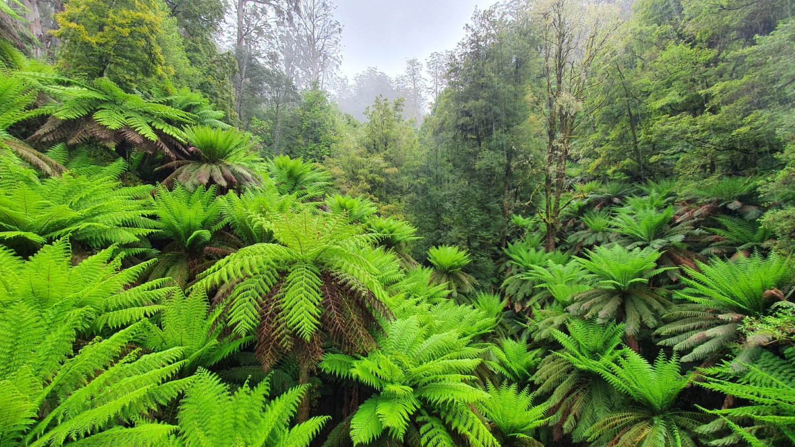
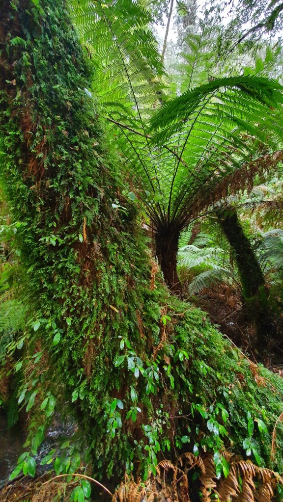
This time it wasn’t the birds that woke me up, but instead it was some heavy rain and very strong winds. I turned the car away from the coast towards Tarra Valley and Cyathea Falls. When I got to the Tarra Valley, the farmland scenery transformed into narrow road twisting and turning in the middle of a temperate rainforest. Usually, you associate a rainforest with a tropical weather, but down here in Victoria the rainforests are a bit cooler. The outside temperature in the car showed about 11 degrees Celsius. When I got to the rainforest, of course the semi cloudy weather turned to greyer with occasional light showers. It wouldn’t be a rainforest without rain, so I guess it was just the appropriate weather for it. The Cyathea Falls consisted about 1,5 km hike in the middle of very lush scenery and I think the way there and back was more interesting than the falls itself. In addition to watching, also listening the rainforest was great as there were a lot of birds singing. I didn’t spot any other animals than those birds though. Most prominent vegetation in the rainforest there seem to be all sorts of big ferns. There are also lots of huge Mountain Ash trees, which usually grows 70-100 metres tall, making it the second largest species of trees after the redwoods.
Lush vegetation at Tarra Valley rainforest 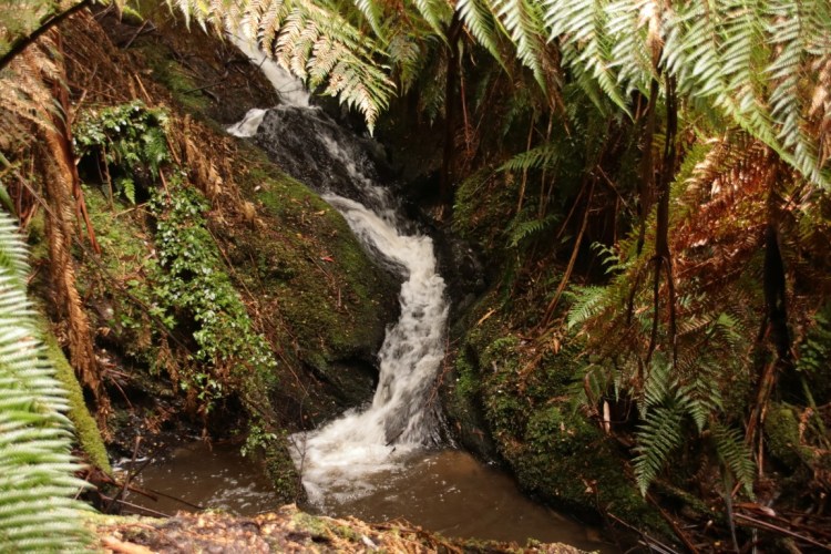
A waterfall at Tarra Valley rainforest 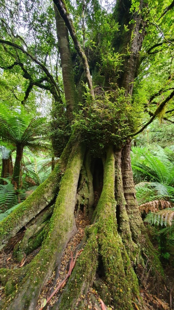
Interesting looking trees are plentiful
After Cyathea Falls it was only a short drive to the next stop, Tarra Bulga National Park. There I had another hike in the rainforest that was about 2,5 kilometres long. It included again the lush greens of a rainforest, listening of the birds, and crossing a Corrigan Suspension Bridge in the middle of the rainforest. I really enjoyed both trails as they were the first rainforests for me, but then it was time to move on away from the forest. On the way out I noticed a lookout spot of a Mount Tassie next to a TV tower and I decided to have ad hoc stop. It had some nice views to the lower terrain in the north.
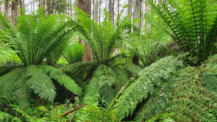
Big Ferns at Tarra Bulga National Park 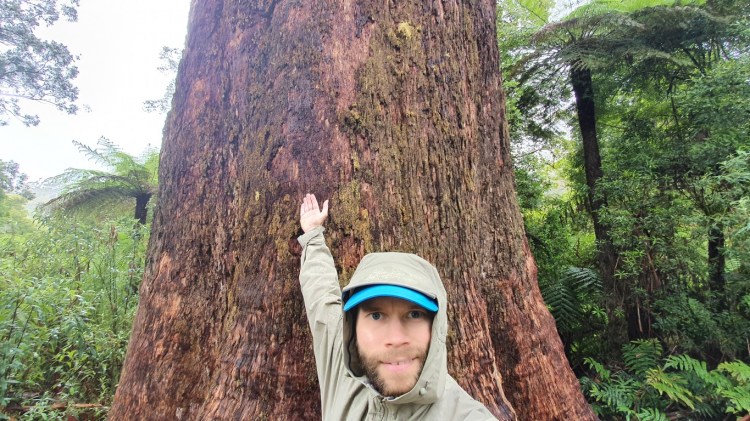
One of the huge trees of the rainforest
For the next interesting bit, I had planned a stretch of road called Grand Ridge Road, which I had read about when planning the road trip. It was a memorable 42 km drive through hilly countryside. I had to mostly just take mental images as the road was very narrow and there were very few places to stop the car, so I missed many photogenic sceneries with the camera. After that all that was left was a drive to the next accommodation in small town of Millgrove next to Yarra Ranges National Park.
Countryside at Grand Ridge Road 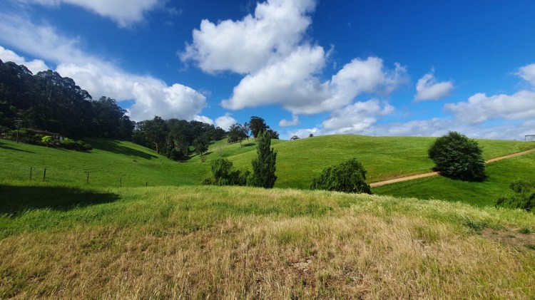
Another hilly farmland
Day 4
Then it was the last day of the road trip. I went to grab a breakfast in Cog Bike Cafe, which is a combination of bike service/rental and cafe services. The town the cafe is in is Warburton, which the end point of Lilydale-Warburton Rail Trail, a 38 km long bike trail going along a historic railway line. I got interested in that, so I have to drive my bike to a train to Lilydale some weekend and go for it. I’ll bet there will be some nice scenery.
But back to the present day and the road trip. Originally the first stop would have been in a close by Redwood forest, which is another place where redwoods has been planted in Victoria. I had to however change that plan as the place was closed for the same reason as the Thousand Steps. Well, I had already seen the redwoods in my first road trip, so it wasn’t a big bummer. The next location in my route was Rainforest Gallery, which contains a 350 metres long elevated walkway through a rainforest and a 40 metres long observation platform. Almost immediately after starting from Warburton the roads again narrowed quite a bit and the uphill started.
In the Rainforest Gallery the elevated walkway was closed because of some storm damaging the walkway, so all I had was the observation platform. Well, that was a short visit, but I guess I had seen my share of rainforests and I think they are cooler on the ground level anyway. As a backup choice for the Redwoods and for the short visit to the Rainforest Gallery, I had found during the morning that there is a nearby mountain that has road going all the way up and it didn’t veer off my course at all, so I headed there. The town of Warburton is about 160 metres from sea level and the Mount Donna I was headed rises to 1250m so it was quite the climb in twisty narrow road, but nothing Yaris couldn’t handle. The top had a 21m high observation tower, which offered quite nice views to take few photos. I also saw one that had come there by bike, so that should be quite nice exercise to do that climb.
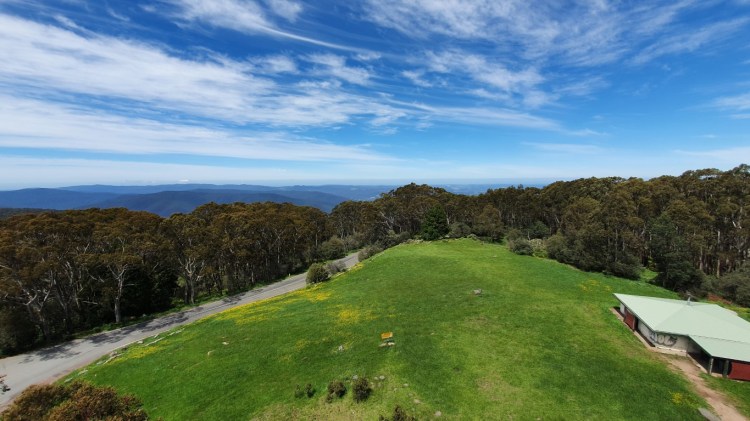
View from the top of observation tower at Mount Donna Buang
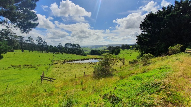
The road through the mountainous area to my next target ended up being very narrow gravel road, which also log trucks are using. The big potholes covered the gravel road all the way, so the driving was quite careful with my small car. There were quite many places that I didn’t want to face oncoming traffic. Gladly there wasn’t much of that and all those were at decent places to have two cars side by side. After about 13 km the asphalt started again. The next target was again a stretch of road I had read about. It was a 28km long Black Spur Drive that was a good wide road through lush forest landscapes.
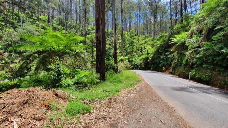
Twisty and narrow roads in the middle of rainforest
After I had driven through that, my plan didn’t have any other points of interest and it was still early afternoon, so I didn’t want to drive back home yet. I selected a close by Maroondah Reservoir Park, which contains a 290m long dam built in 1920’s that holds one of the reservoirs feeding potable water to Greater Metropolitan Melbourne.
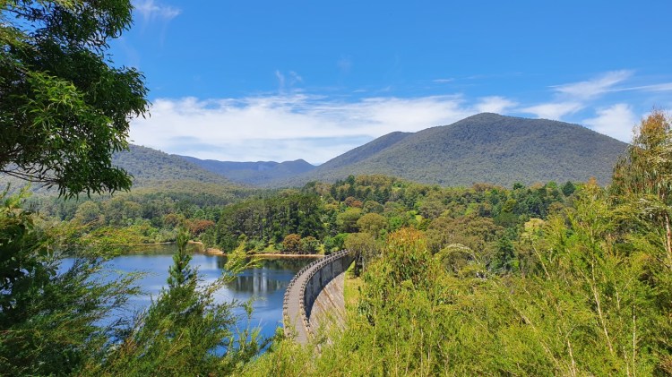
The dam and reservoir at Maroondah Reservoir Park
Then it was time to turn the car towards Melbourne. The way there took me past lots of wineries as it was Yarra Valley that hosts over 70 of them. If I were more of a wine enthusiast, I would probably be already planning a wine tasting trip there. All in all, even if the last day didn’t have so much content, this was a great road trip once again. The state of Victoria has some great nature to explore and I have again just scratched the surface. For the next location I might venture outside of Victoria now that all the states have opened their doors to Victoria, so maybe Tasmania or Queensland. I have now less than five months left so I have to start planning the next one, so I don’t run out of time.
