Just before Christmas, a surge in local covid cases appeared in the Sydney suburbs. Between Christmas and New Year it also leaked to Victoria. After a streak of 61 days of no local cases in Victoria, the corona again raised its ugly head. Of course, I was concerned as I was in my last four months of my stay here, which I wouldn’t want to spend confined in my home again. At worst, there were around thirty local active cases and a lot of exposure sites around regional Victoria and Melbourne so there was a chance of the situation going bad again. I guess they did learn something from the second wave in contact tracing and other preventive measures as the situation is pretty much back to normal. Today was the 18th consecutive day without new local cases and only one known active locally acquired case.
But that’s enough for the covid update and more about my third road trip. This time the driving itself wasn’t the main attraction, but instead, it was just a method of transportation between home and the target location. The main event was a couple of days hiking in the Grampians National Park. Before that, I spent the first day in Ballarat, which is the third-largest city in Victoria and it was also directly in my route to the Grampians. Ballarat became a world-known city back in 1851 when gold was discovered there. It triggered the Victorian gold rush that lasted almost two decades.
Day 1
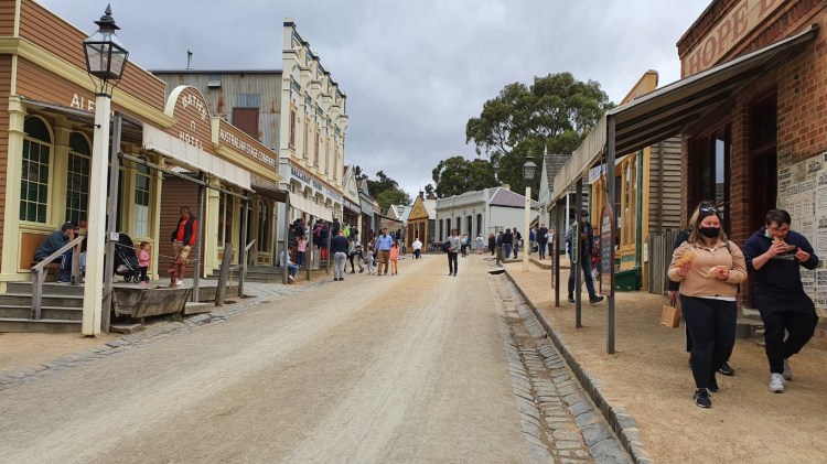
For deciding what to see in Ballarat, it wasn’t a hard choice to pick the top tourist attraction of Sovereign Hill. It’s an open-air museum based on top of one of the gold mine sites in Ballarat and it includes a lot of historically recreated structures from that era that was built around gold sites. The staff and volunteers are dressed in historical costumes so you get some feeling about that time. There were several machines from that time still functional. For example, they had demonstrations of wheel manufacturing and a blacksmith showing how to shape steel.
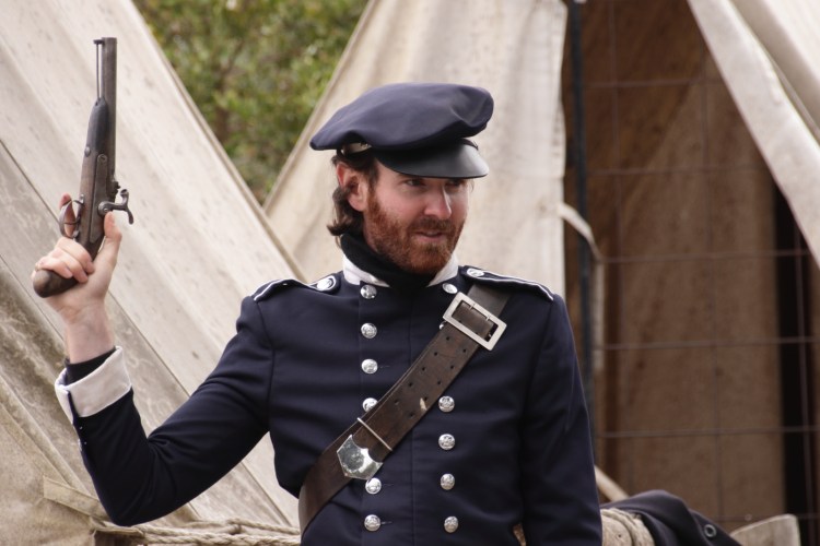
Goldfield police with a flintlock pistol 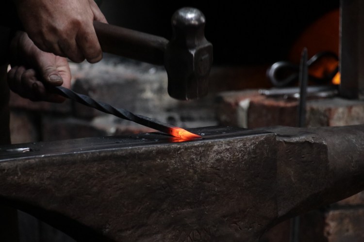
Blacksmith forging steel
One of the attractions I participated in was a mine tour, which took the group about 20 meters underground. The mine train ride there was in total darkness where you can’t even see your hand in front of your face. There are only a few places where you can experience that kind of total darkness. The mine tunnels were dimly lit but the total darkness was a good acclimation for the eyes coming from daylight. Being a gold miner for a mining company didn’t feel like a very nice job back then. You would get paid only when you arrive at the mining level and drilling and blowing up quartz isn’t healthy for your lungs. It throws in the air very small and glass-sharp particles that aren’t good to breathe in. When I exited the mines to the open air, the brightness was quite blinding before the eyes adjusted again.
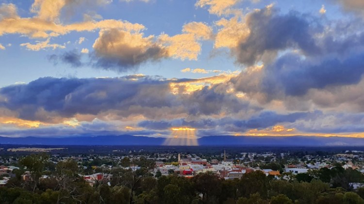
It was very interesting to see and hear stories about the living and working conditions back then about 170 years ago. After leaving Sovereign Hill, I visited the Botanical Gardens of Ballarat while looking for a place to eat. It’s situated next to Lake Wendouree, which is a big artificially created shallow lake in the middle of Ballarat. Then it was time to drive closer to the Grampians, to the accommodation in Stawell. It was a Victorian-era house that had been modernized to make it nicely part old and part new. I would have liked that also the shower faucet was modernized as I’m not a fan of the separate hot and cold faucets. After I settled in, I made an evening walk to a nearby hill to check out the local scenery. I got quite lucky on the clouds as the setting sun threw some nice god rays behind the city.
Day 2
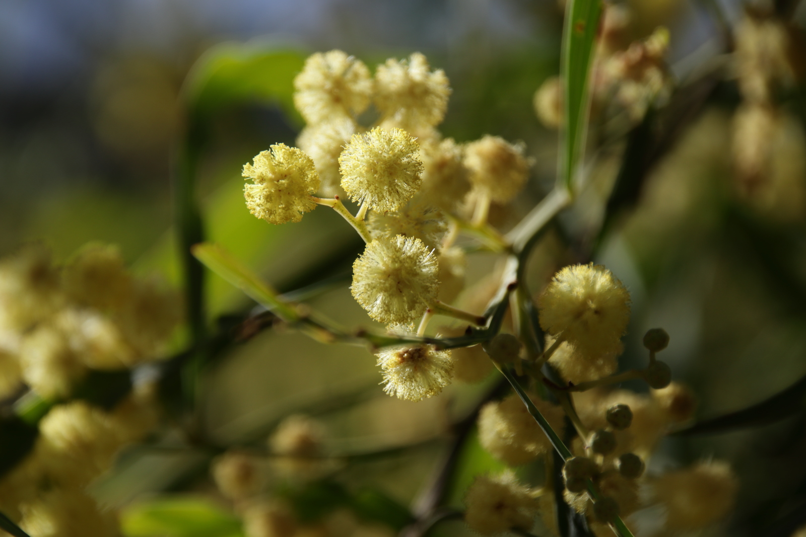
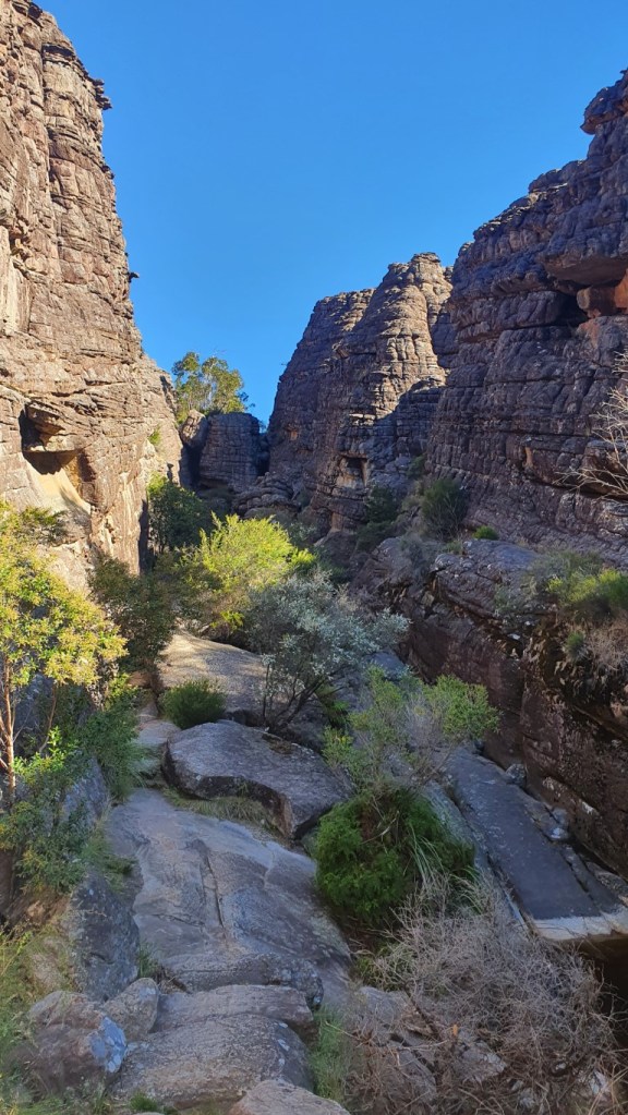
The main hub of the Grampians, the village of Halls Gap, was about 30 minutes drive away. After having breakfast there I headed to my first hike. I wasn’t going to start easy, as the first hiking route was Mt Rosea, which is about 11 km round trip with a bit over 500 m elevation difference. If I chose to return the same trail, it would have been just 9 km but it’s always better to have a round trip rather than backtracking the same path. Quite soon after I started the uphill climb I could see the rugged terrain, jagged ridges, and all sorts of interesting shaped sandstone rocks. They have formed sometime about 380 million years ago, so a quite old group of ranges sticking out in the middle of flatlands.
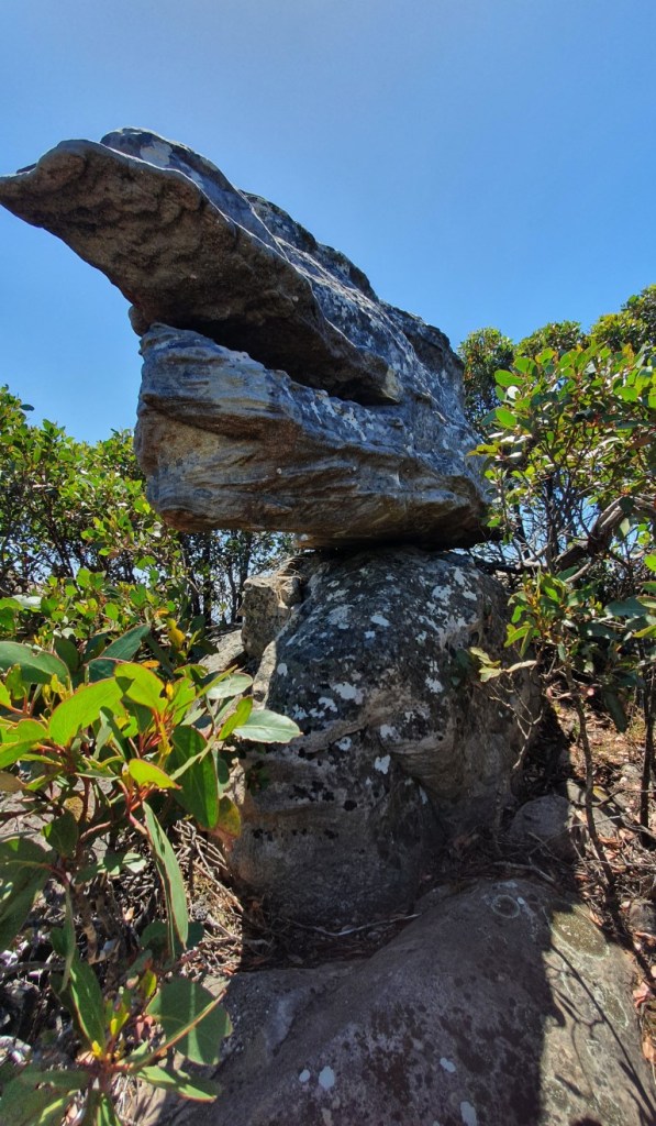
Some curious rock formations, or pile in this case. 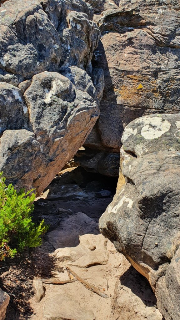
The yellow arrow points, yes the path goes there.
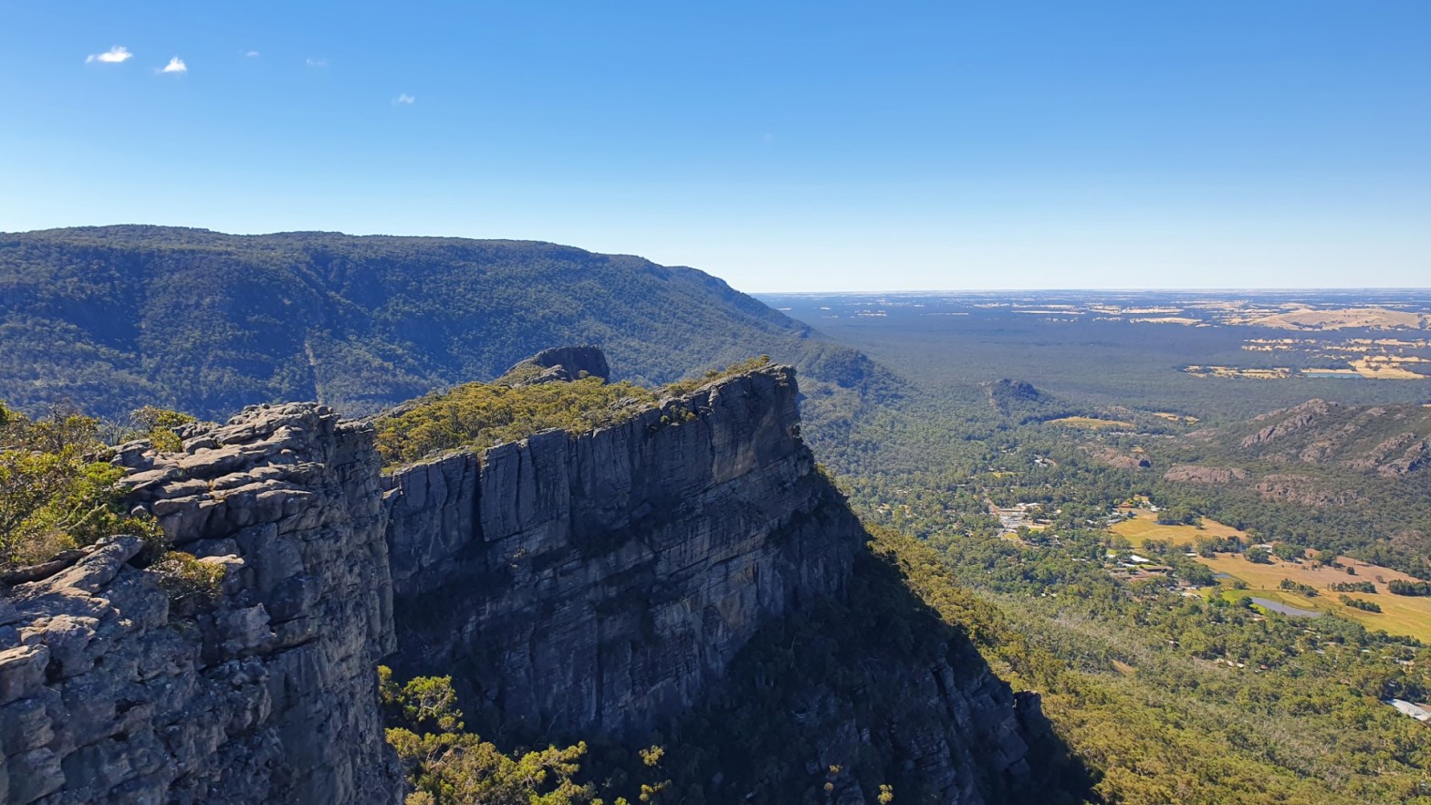
The weather was quite pleasant with about 20 degrees Celsius, no clouds, and some light breeze. Steadily I gained altitude on the trail and the scenery started to open up. The path eventually reached the edge of the ridge and the views there were great. The nearby Lake Bellfield and the other hills with the flat plains made a quite nice backdrop in the photos. Along the ridge, the path had very interesting twists and narrow spots between huge rocks. At some places, I had to go humbly and duck to not hit my head. At the narrowest spots, it was only about the same width as my shoulder to shoulder, so I would imagine that for larger persons it would have been a tight fit. After a while walking on the ridge I reached the peak of Mt Rosea at 1009 meters above sea level, which was also the highest point on my trip.
Picturesque view in a ridge near Mt Rosea 
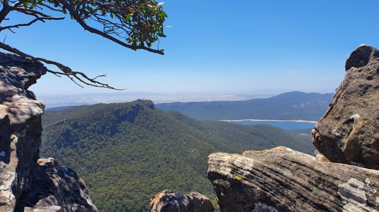
View of the Lake Bellfield from Mt Rosea
After taking in the scenery, resting a bit, and having some snacks, I started heading downhill continuing in the same direction for the journey back. The round trip wasn’t as popular as returning the same path as there were fewer people I came across. It also wasn’t as well maintained with the path having branches hanging over and at other places trail seemingly just ending up in a dead-end. There were a couple of places where an old landslide had cut the path and continuing on the other side. I eventually reached the road and after walking a kilometer uphill at the side of the road I reached the car. The hike took about 4,5 hours with a moving time of 3 hours.
After the long hike, I still had the energy to visit a couple of locations that didn’t have a lot of walking. First I went to a Reed Lookout and from that to The Balconies, which was about 1km walking distance away. Quite nice viewing points from slightly different angles. While walking to The Balconies, I think I saw my first glimpse of a wild kangaroo as at least I think I recognized it when it quickly crossed the path.
Rocks looking a bit like a moray eel head at the Balconies
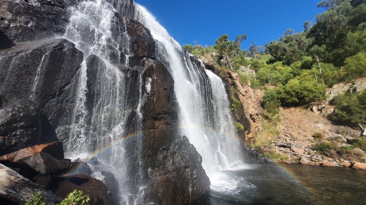
And what would be a road trip without at least one visit to a waterfall, so after the previous spot I drove to MacKenzie Falls. It was the best falls thus far in Victoria I have visited with good width and height. It wasn’t the easiest on the wearied legs after the hike, as 260 narrow steps have to be descended when going to the base of the falls. And of course, those same steps back up when leaving the place. But it was well worth it to visit.
After that, I was so done for the day. I just had a hunger I needed to satisfy and after having a good pizza in Halls Gap, I headed back to the accommodation. My watch showed for the day 8 hours active time, 25835 steps with the estimated 16,3 km of walking, so there wasn’t any trouble to fall asleep that evening.
Day 3
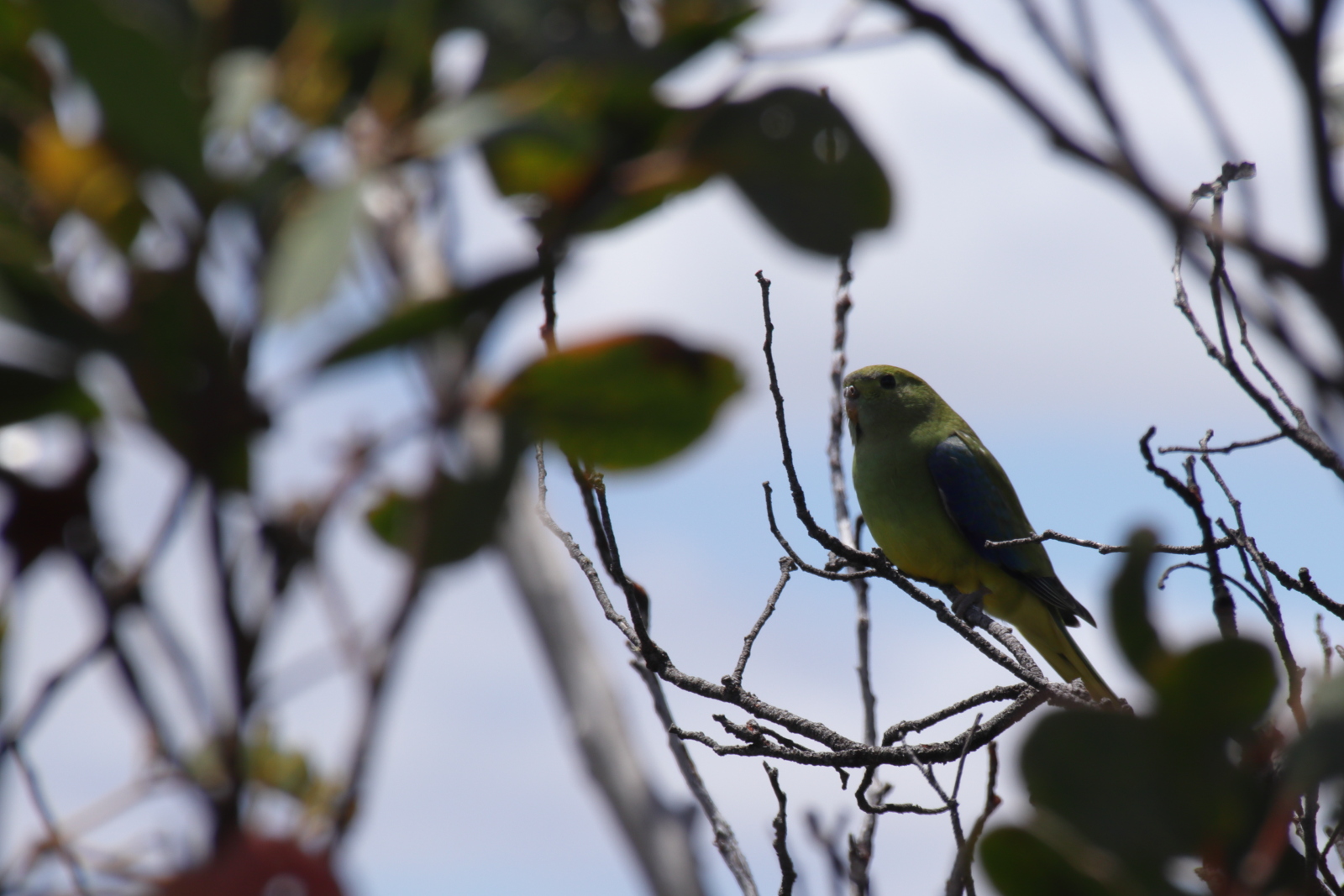
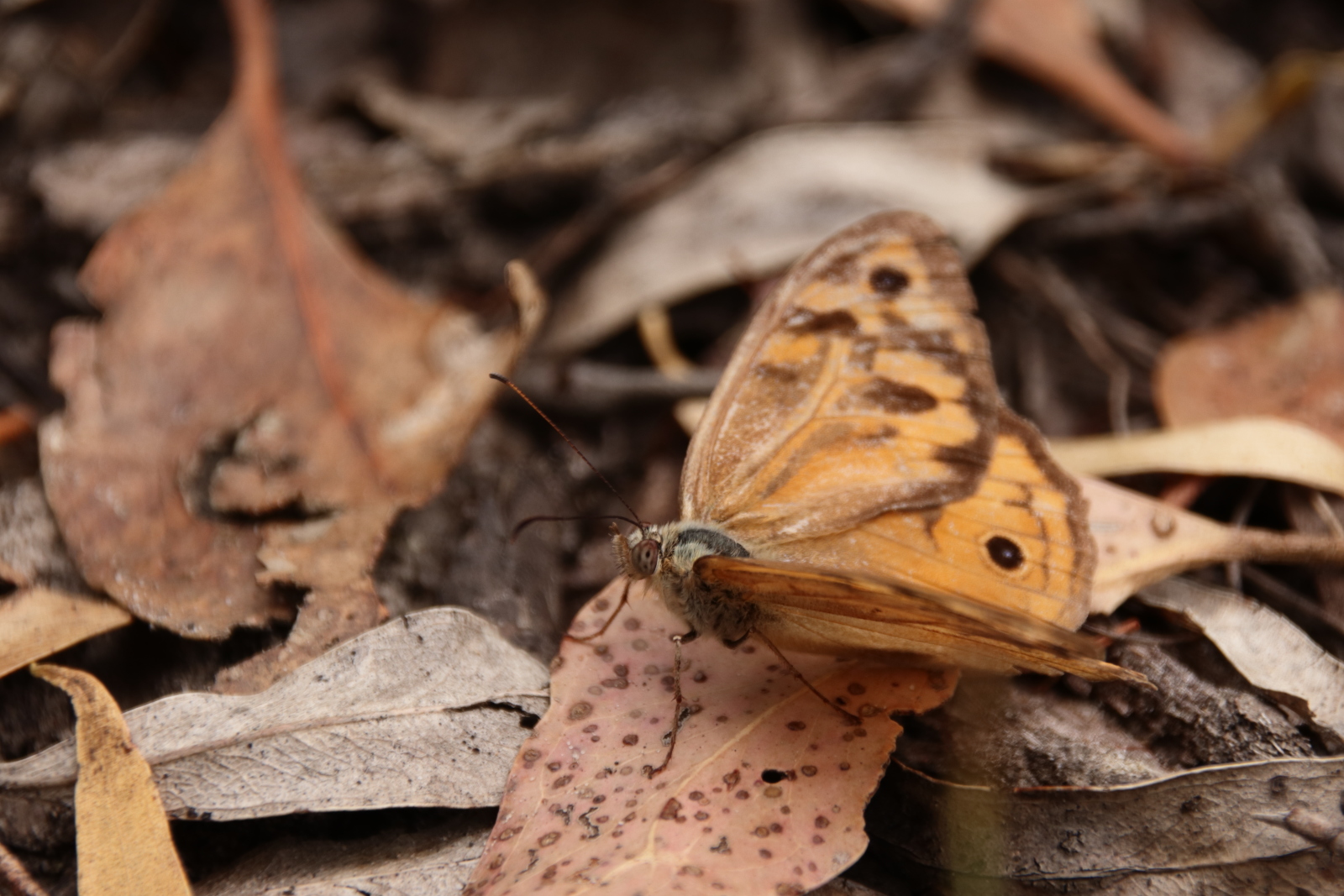
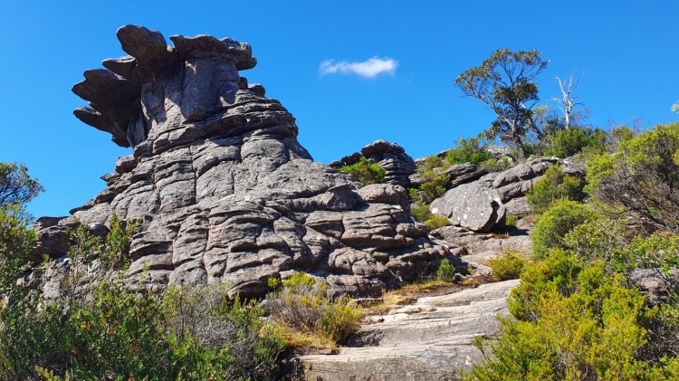
For the second and last hiking day, I wanted to start with totally different scenery. I chose Mount Abrupt for my first hike, which is at the south end of the Grampians 56km drive away from the Halls Gap. Just before arriving at the parking spot, the mount was recognizable as it abruptly raised from the scenery. It was about 3km uphill walk with 450 meters of elevation difference. The day was a bit warmer than the previous day, with maybe about 24 degrees Celsius. It quickly got warm and I didn’t have to think of putting my coat on like the previous day. Before getting above the treeline it was quite sweaty but after that, the breeze brought some comfort. It was a pretty lonely walk as there were only two other cars in the parking place and also along the trail I ran across with only a couple of other groups. Of course, it being a Monday might have also had something to do with it. The woodlands part of the trail had a couple of old landslide openings, where a storm in 2011 swept away the path. There were warnings that it may occur again after heavy rain. For me, there wasn’t any risk of rain as it was only partly cloudy. The climb up clearly felt more heavy on the legs after the previous day of hiking, but I eventually reached the top after a little over an hour of hiking. The view was again spectacular with 360 degrees of visibility at 832 meters above sea level. There is supposed to be a chance of spotting eagles, kestrels, or falcons, but I wasn’t that lucky. I had to settle for birds and butterflies.
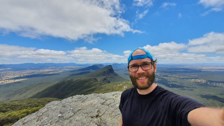
On top of Mount Abrupt 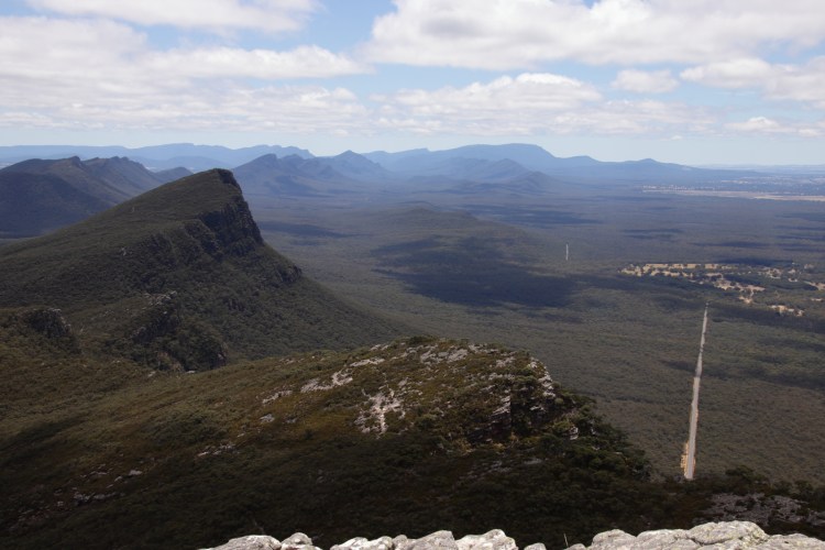
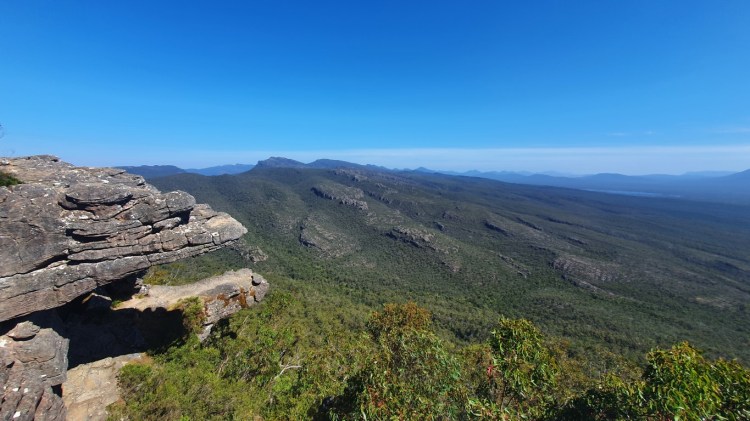
Northern view from Mt Abrupt
As this had only one path up, I had to backtrack it back down. The plus side of that is that you see the other side of the scenery, as you might miss something unless turning around constantly. I finally got back to the car after almost three hours of hiking. In my planning notes, I had written down that after Mt Abrupt I would pick up small hikes near Halls Gap that I hadn’t done yet the previous day. I underestimated the effort of these “small” hikes as I had written it in the plural. Going 3km up 450 meters and then down is not an easy walk. As I hadn’t yet visited the most popular scenic location and the highlight of the Grampians, I chose The Pinnacle for my next hike.
Based on the car parking this was a popular route. Even though the trail to the Pinnacle was only 2 km with 292 meters of elevation, with all the already walked kilometers and warm and sunny weather, it wasn’t an easy walk. The terrain was very rugged rocky terrain and there were plenty of interesting formations of the local rocks. It again had very narrow spots between rocks and one part of the trail went through The Silent Street, which had the trail going in a small canyon. During the hike, it was getting clear that this was the last hike for the trip, as it was already a late afternoon and the legs were getting tired.
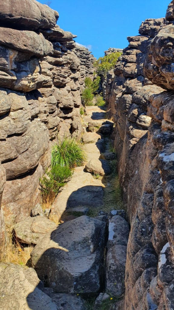
The Silent Street 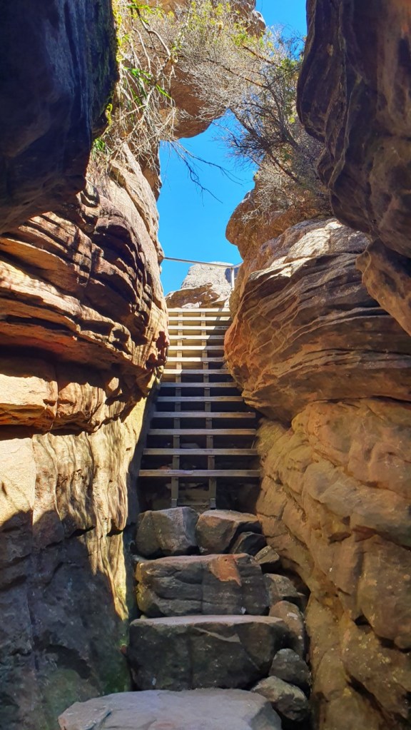
Climbing the narrow steps away from the Silent Street
Again I was awarded in great scenery at the top with very windy conditions. I had to be careful in taking photos with the phone at the peak overlooking the Halls Gap. There was an option to have a part of the trail as a roundtrip and I decided to take a long way down. It pretty much went around the rocky terrain and instead traversed through a little boring woodland trail, but I guess I didn’t mind it at that point. After getting back to the starting point, I walked an extra few hundred meters to a Grand Canyon and back. Normally it’s an alternative route along the way to the Pinnacle, but it had a staircase section closed due to some structural damage.
The Grand Canyon near The Pinnacle 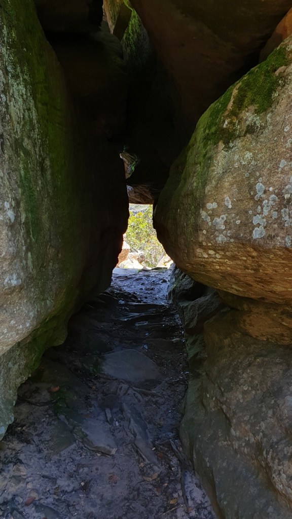
Another tight squeeze along the path
After about 3 hours of walking, I got back to the car and I was so ready to start heading back to Melbourne. Even if I still had the energy to do a hike, I had to go eat and after that, I wouldn’t have been able to complete any hike during daylight. I guess it had however good amount of hiking for one trip. The day ended up being at least as heavily loaded as the first hike day. I accrued 26207 steps with an estimated 16,2 km of walking during the 9,5 hours of active time.
It was again a successful road trip in this state. Most likely the next trip will be on my summer vacation that should start in a few weeks. Then it’s time to visit some other states, like Tasmania or Queensland. Those can be quite exciting ones, for example, a while ago Brisbane, the capital of Queensland had a covid case surge and it turned to a hot zone, which meant that Victorians that were there, needed an exemption to return and needed a hotel quarantine after coming back. During the long vacation, there is more leeway on the schedule if the return trip is delayed. And of course, I’m still hoping that New Zealand and Australia open the two-way travel bubble.