The second attempt to travel to Tasmania was a success as the five-day snap lockdown ended as planned. Also, the hard border to travel to Tasmania was lifted a couple of days after the lockdown ended and no more covid cases surfaced. Since this was a week-long trip, I decided to split it into two blog posts.
Day 1
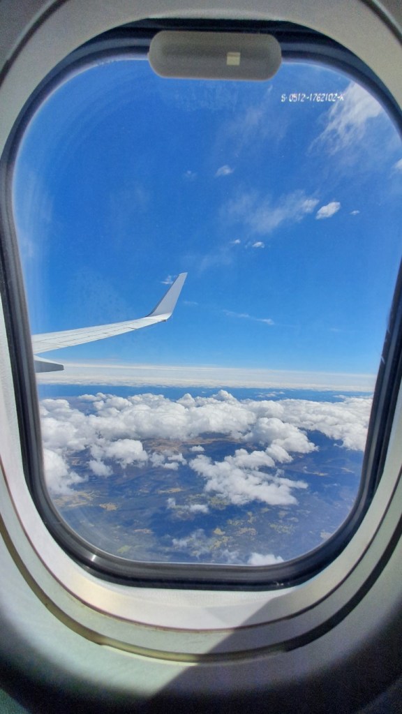
The flight schedule was changed before-hand and I had the option to change the departure to one day earlier or accept instead of arriving at 11 to arrive at 15. I decided to accept the latter choice so I had four hours less time for the first day. Of course, I could have just planned an extra day seeing the south side of the capital Hobart as it wasn’t in my original plan. With the less amount of hours, I thought about skipping some of the locations I had marked for the first day but ended up keeping them.
The first stop was a place called Remarkable Cave, which is a tunnel carved into sandstone rocks by erosion by the sea. Apparently, in a low tide, it would be possible to walk into the tunnel with dry feet, but I think it wasn’t the case on my timing. I didn’t see the way there anyway and as my schedule was tightened, I had just the time to visit the platform, take a few pictures, and return to the car.
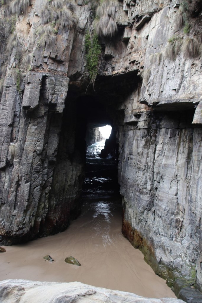
The Remarkable Cave 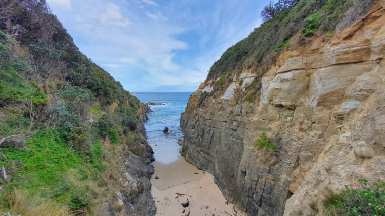
Narrow beach near the Remarkable Cave
On the way back along the coast up north I stopped at another geological phenomenon caused by the erosion over time. The Tessellated Pavement is an extremely rare rock formation as it is found only in a few places on Earth. It has formed about 300 million years ago by the combination of earth movements, the siltstone, changing tides, and constant waves. This location was very much worth visiting despite the tightened schedule.
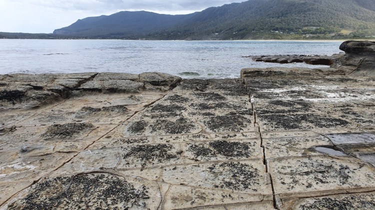
Pan formations of the Tessellated Pavement 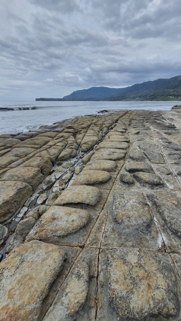
Loaf formations of the Tessellated Pavement
That was all the attractions I had planned for the first day, so it was time to drive to the accommodation. At one point the navigation said about an intersection to turn right or go straight with 13 minutes longer drive time. Well, I of course took the shorter route as it was getting late. Soon after turning, I noticed that the road turned into gravel. As the condition of the road seemed to be ok I decided to continue. There weren’t any potholes and I drove carefully around the corners and took no risks. Momentarily I bypassed a sign that said that you should have a 4-wheel drive car on this road as the condition might change rapidly. I got a little worried and thought about turning back as I was still only ten or twenty minutes into the road. But as the road hadn’t shown any bad conditions yet, I pushed on. There were some bad spots where I had to be careful, which again made me doubt my choice. I wouldn’t have wanted to get stuck in this bit of road as there wasn’t any traffic beside me, there wasn’t much reception on the phone, and I wasn’t sure would the rental car insurance cover the roads that have gravel instead of tarmac. Well, I survived the road and the asphalt under the tires felt smooth after 34 km of the gravel road.
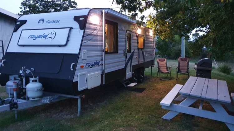
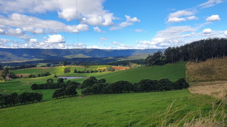
The first Airbnb place in the original trip was the one that I had to cancel as it didn’t have a vacancy for the postponed day. I ended up finding another accommodation option from the same host, which was a newish caravan. I never had experienced a night in a big caravan. The only similar experience was from my childhood where our family rented a small campervan once. And as the trip already had some out-of-the-ordinary accommodations booked, I selected it for the experience. During the evening the wind picked up and I felt it in the van as it rocked with the strongest gusts. Too bad that it was already dark when I arrived there as the place was a farm, which would have been nice to check out. But that is sometimes the nature of these road trips, that you have to keep going.
Day 2
It was time to head out to the first hike in the Freycinet National Park, where I had selected Mt Amos to be conquered. Before that, I stopped by a grocery shop after having breakfast to get some snacks for the hike. As accustomed, I carried the face mask in my pocket as I had gotten used to always wear it in shops since mid-March last year. As I didn’t see a note about them being mandatory and as nobody else wore it, I left it in the pocket. It felt very weird and almost naked to walk among the aisles between the shelves without the mask. The automatic reaction to put the mask in my pocket when leaving the car subsided in one or two days. A little taste of normality there felt refreshing.
I had read about the Mt Amos trail that it consists mostly of rocky sections and it shouldn’t be ventured in wet conditions. I did check the forecast beforehand and it did tell that rain is coming in in the afternoon. I had calculated based on the length and the elevation gain that how much time I would have to have for the hike to make it out before the rain. I arrived at the National Park Visitor Center about on time, where I had to buy an entry pass for the park. I noticed there that they warned about a virus that is spread by mosquitoes and recommended an insect repellent. The visitor center was out of stock and they guided to drive to the nearby town where it should be available. Since it was still windy like the previous night, I decided to save time and go without it. In addition to the wind, it also wasn’t so warm and I had the hiking pants and jacket on, so I didn’t have a lot of exposed skin.
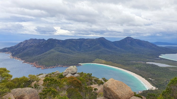
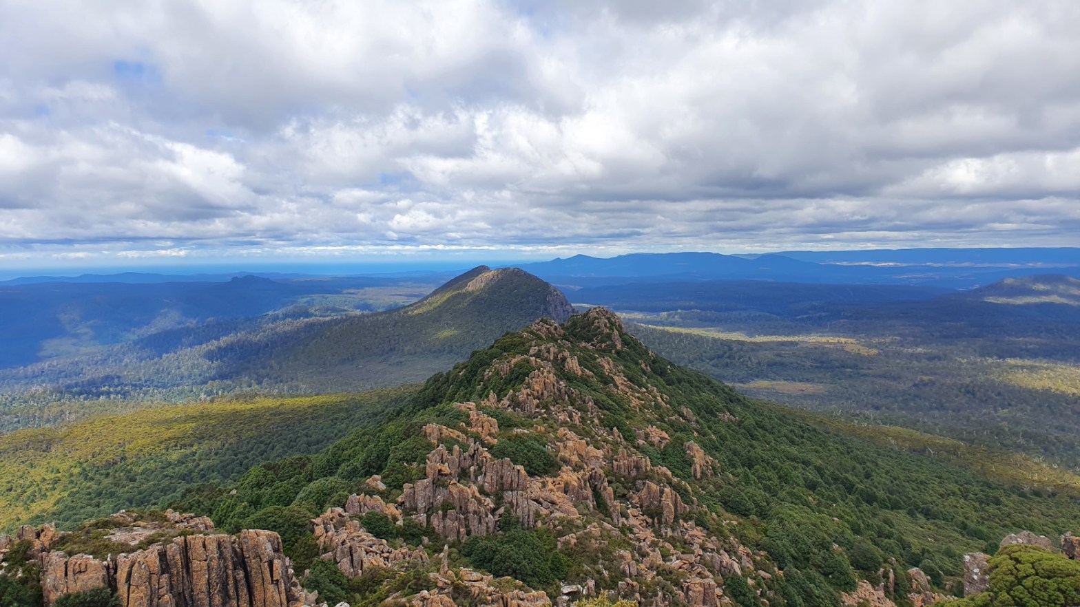
View towards Wineglass Bay from the top of Mount Amos
It wasn’t long after I started the hike that the smooth rocky sections began. There were some points where the ground was wet and as soon as my hiking boots got even a little moisture to the bottom, I noticed how the grip disappeared and just slipped on the smoothest parts. Then I understood that it’s quite paramount that I make it down before the rain. Whenever there was mobile data available, I checked the weather radar and the rain front was creeping forward towards me as forecasted. After careful footing and at some points using all fours to move up, I finally reached the summit of Mt Amos at the height of 442 meters above sea level, and again the views were the reward for the effort. I didn’t rest a long time up there as I had a deadline I didn’t want to miss. During my descend I already saw the rain across the big bay. After reaching the car park it didn’t take long before the first raindrops started, so I would say that the timing worked very nicely.
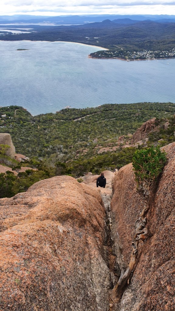
Descending Mt Amos 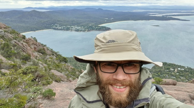
Selfie moment during the descent from Mt Amos.
After the hike, I drove north along the coast to a small town, and while waiting out the rain filled the stomach in a café. Nearby I had another interesting nature location next to the sea. This time it was a blowhole, which was a hole in the rocks that converted some of the waves into an upward stream of water through it. Then it was time to drive to the next Airbnb place, which was a relatively normal flat next to the host’s house. As I had some time before sunset, I went for a walk to a nearby beach. That part of the beach is reserved for offroad driving but at that time there wasn’t anybody using it.
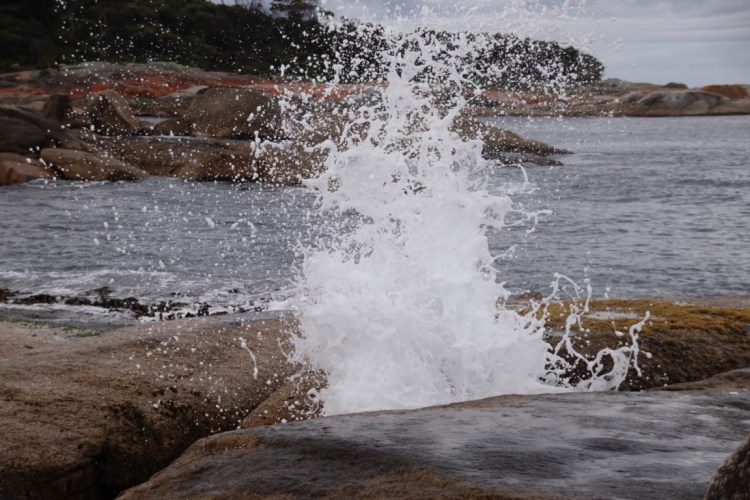
Bicheno Blowhole spurting out seawater 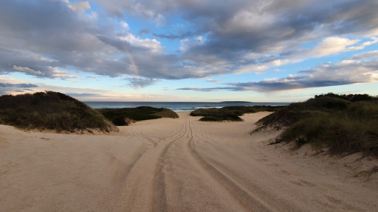
Offroading tracks in the Maurouard Beach
Day 3
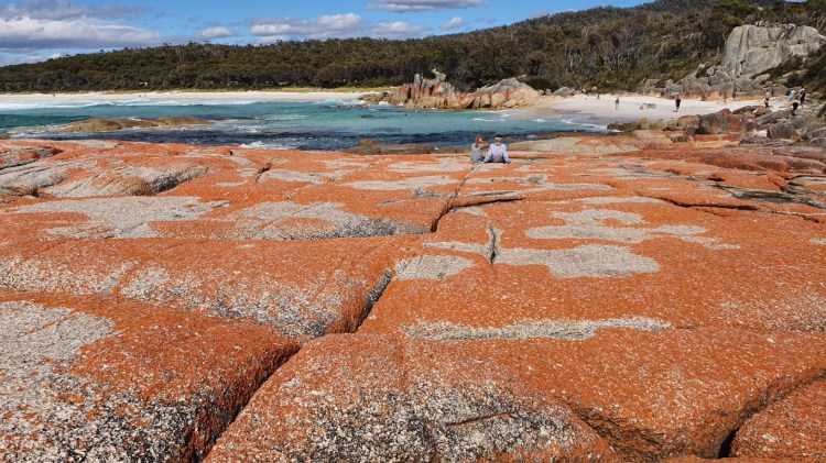
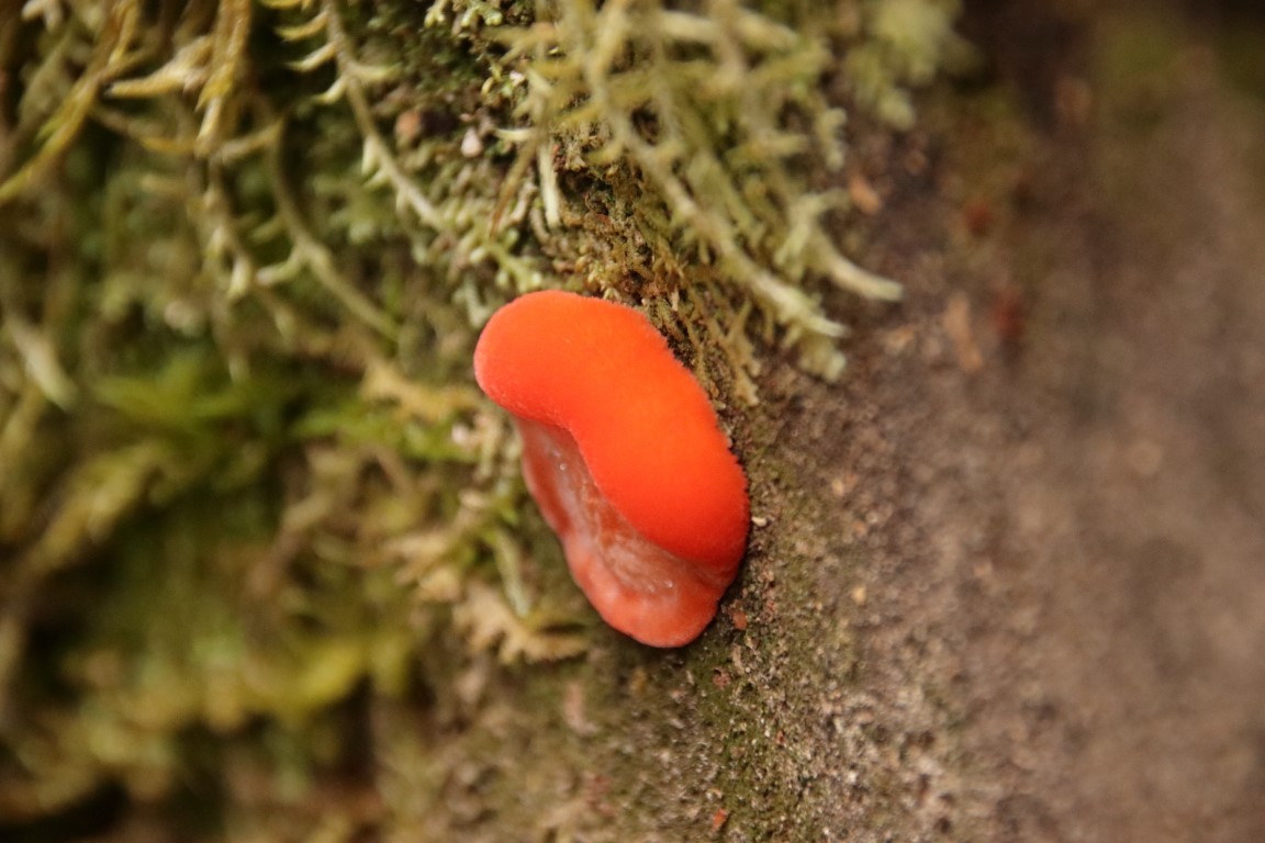
In the morning after having breakfast in the next town, I selected as an ad hoc to check a close-by location at the Bay of Fires. It was another natural phenomenon where coastal rocks have gotten an orange color from a certain type of lichen. After that, it was time to head west away from the coast. It was time for another gravel road that I had read that was a scenic drive. In my opinion, there wasn’t much to see along that road, but instead, it was a road of careful driving. Generally, it was in better condition than the previous gravel road. I had marked a more secluded mountain hike that started along that gravel road, which was also the reason I had selected it.
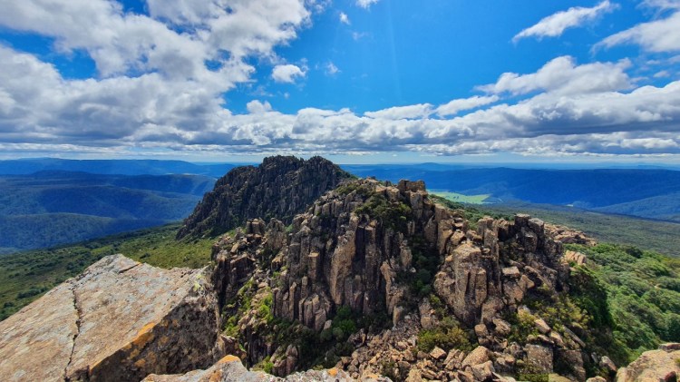
The target was Mount Victoria that had the summit at about 1212 meters above sea level. The elevation gain and the length of the trail were about the same as the Mt Amos, but this time I didn’t have oncoming rain so I didn’t have to hurry. The car park area was a bit hidden and first I overshot it and it ended up being empty, so I knew that most likely there wasn’t anybody else hiking. Without reception on the phone, I had to be careful as the last section of the path included some boulder climbing. The first part was a forest that had a very wet and muddy section, which I had read about before, so it didn’t come as a surprise. It wasn’t too long part and as my hiking boots are waterproof, I didn’t have issues there.

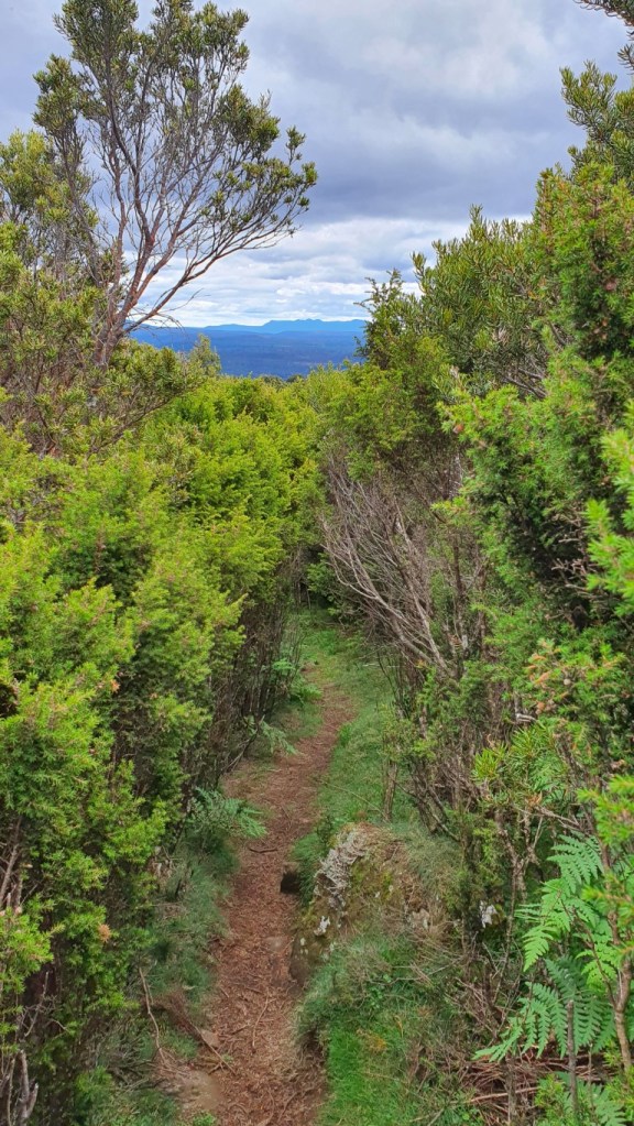
After some uphill section of the forest, the terrain changed to a path in the middle of two meters high hard bushes. That was a bushwalk in the literal sense, where at some points you couldn’t see the path where you set your feet. As in Australia, you have to watch out for the snakes, it wasn’t the most comfortable section. After the bushes started the last and most challenging terrain types. It consisted of different sizes of boulders that I had to climb and step over big gaps. My day hike 34-liter backpack also isn’t optimal for that kind of technical scrambling and climbing. There were some bits where I doubted myself that should I continue forward or turn back. I kept going forward. For the toughest last bit of climbing to the summit, I left the backpack behind to make it safer. And as there wasn’t anybody else, I didn’t have to worry that somebody took it. I finally reached the summit and the views were great and made the hard effort again worth it. The car park was just a speck in the distance. Shortly after I thought that it almost looked like another car there, I was joined in the summit by another lone hiker.
After some small talk, I started to head down knowing that usually, the tough spots are more challenging coming down. At least I knew that I was followed by the other hiker if somehow I got injured. Compared to the day before, the winds were quite calm so the hike was quite pleasant without being too hot weather. Because of the more technical nature of the hike, it lasted almost the double-time I had used at Mt Amos the previous day. But I did manage to return to my car unscathed and shortly after the other hiker also returned there.
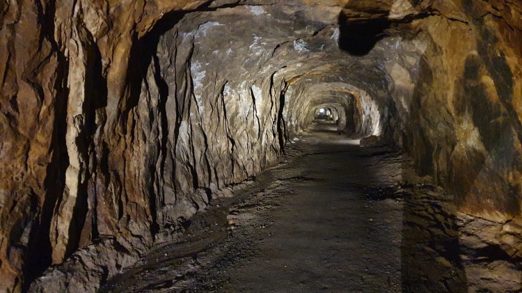
Before heading toward the next accommodation, I checked out a town that had the biggest activity of mountain biking. The reason I had it marked on my plan was a tunnel that was part of the mountain bike trails. The tunnel was built in the late 1800s as part of the tin mines in four years and the length of it is about 600 meters. It’s the only tunnel that hasn’t been filled or destroyed since the mining days and now it’s part of the mountain bike trail network. With more time on my hands, it might have been a nice experience to rent out a mountain bike there.
Then it was time to head out to Launceston, which is the second-most populous city in Tasmania where my next Airbnb place was located. It was again a normal apartment within the same building as where the hosts lived.
The trip continues in the next post that I’ll post in a few days, so stay tuned.

One thought on “Tour de Tasmania part 1”