This is the second part of my trip to Tasmania. If you missed the first one covering the first three days, you can check it out here before continuing to read this post.
Day 4
After breakfast, I went to visit the Cataract Gorge in Launceston. It is a public park in the city containing some walking trails, a swimming pool, a suspension bridge, and the world’s longest single-span chairlift around a basin in a gorge. I didn’t however ride this 457-meter long chairlift that was built in 1972. I walked around the basin and over the suspension bridge and a bit way along the gorge upstream before returning to the car.
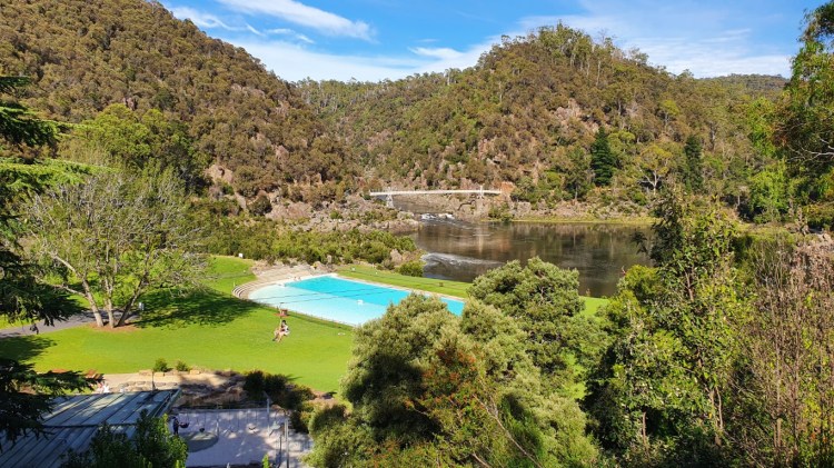
The Cataract Gorge park. Showing the chairlift, swimming pool, and the suspension bridge
The next destination was Tasmania Arboretum near the city of Devonport on the northern shore of Tasmania. The way there included one of the rare bits of road in Tasmania that is a 4-lane highway as most of the roads are two-lane roads. It might have been the first time I could use cruise control in the car. The arboretum is a big park developed by the local community and volunteers that houses trees and plants from around the world. It is supposed to be the best place to see the platypus in nature, but I wasn’t that lucky with my short visit.
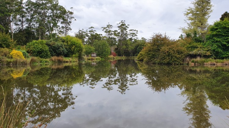
Founder’s Lake at the Tasmanian Arboretum.
When I reached the shore, I headed west and my next location was a beach called Fossil Bluff. This quite ordinary-looking beach had over 23 million years old sandstone cliffs on both sides, which houses hundreds of types of fossils. There was a lot of different kind of shells embedded into the cliffside and the huge boulders that have separated from the cliff. As I’m no expert, I’m not sure if I saw any fossils among the shells but at least it’s the site of Australia’s oldest marsupial fossil found in the mid 19th century.
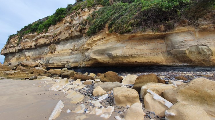
The cliffside at the Fossil Bluff 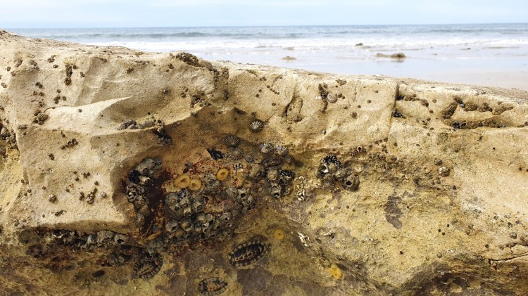
Shells embedded into sandstone rock at Fossil Bluff
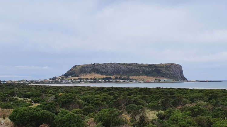
Before heading to my next accommodation, I drove to The Nut next to the town of Stanley. It’s a 143 meters high volcanic plug, rising next to the sea almost like a small version of Gibraltar. A chairlift or tarmac path leads up to the top, but as the chairlift was already closed for the day and I wanted to spare my tired legs for the next day, I didn’t walk the path up there.
The Nut
A little way back east along the shore my next accommodation was waiting. It was a B&B style of accommodation that is also a small farm. The host has two friendly dogs, a couple of cows, chickens, and a beautiful garden filled with all sorts of plants and flowers. The other dog just wanted to be pet and the other just for the ball to be thrown. After photographing the garden, the host took me to see the cows and I took part in the upkeep by brushing Eddy. Eddy weighs more than half a ton, so I had to be careful that he didn’t step on my toes. The other one is Dorothy, who was pregnant and warier of outsiders. After that, other guests of the host arrived there and we watched some footage of three motion-sensor cameras that are planted in the nearby forest. There were some birds and different kinds of marsupials or pouched mammals like the Tasmanian devils, wombats, quolls, possums, and wallabies. I even got a CD with some of the videos, but since I don’t have a CD drive here, I have to wait to watch it when I get back to Finland.
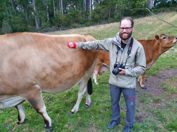
Brushing Eddy to do my part on the farm. 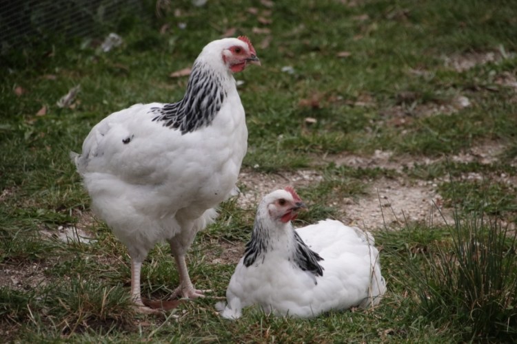
Chickens at the B&B place
Day 5
This was the first morning on my road trips that I didn’t have to find a local café to have breakfast. The host cooked a delicious breakfast where almost all the items on my plate were produced on the farm. With a full stomach, I headed towards the main attraction of the trip, Cradle Mountain National Park. After about two hours of driving, I arrived at the visitor center, bought the ticket to the park, and hopped on a shuttle bus that takes people deeper into the park.
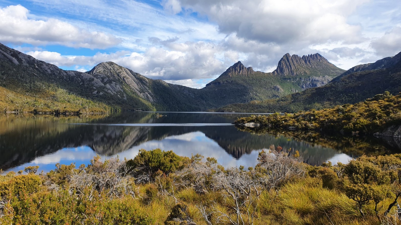
I started my hike just before noon and I planned the route to include the possibility to climb the summit of Cradle Mountain. I did have a deadline though as I had to reach the endpoint of my hike before 6 pm as the last shuttle bus left at 6 pm towards the Visitor Center. That stretch of road was about 10 km long, so I didn’t want to miss that last ride back to the car. The hike started from Ronny Creek where it should be common to see wombats crunching the grass of the open fields there. Well for my luck I didn’t see them when I walked across the open fields. After a small forest section going along a creek with small falls the steeper climb section began. It led to a Crater Lake and from thereafter more uphill path to Marions Lookout. From there I could see that the summit of Cradle Mountain was covered by clouds and I was sure that I didn’t want to even try to climb it if it was obscured. In addition to the last bit being more challenging, also the views wouldn’t reward the effort.
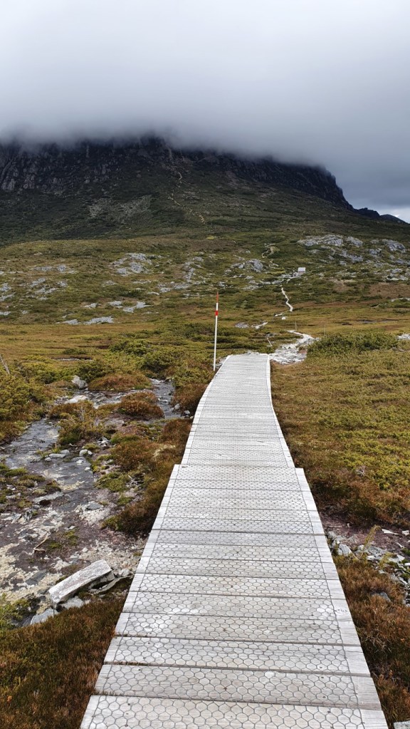
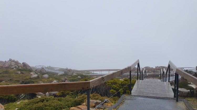
The boarded path toward cloudy Cradle Mountain
From the lookout, it was a bit more flat terrain until I reached the intersection leading to the path to the summit. At that point, I decided that as the clouds were covering the peak of the mountain, I would go as high as the starting point of the cloud. In the intersection, a sign said that the return trip to the summit and back was 2,5 hours and also other hiker returning from there said that it’s about right. As I had about six hours to complete the whole hike and at that point, I had spent just less than two hours, I might run out of time. Well, I still went ahead toward the path to the summit to see what it’s like. After a bit of path uphill, started the technical section of boulder climbing and stepping over gaps. Also, the cloud cover started to move away from the summit. At the elevation of 1468m after 45 minutes from the intersection, the path forward changed to a very difficult climbing section and with my day hike backpack, I felt that maybe this should be it for me. The views from there were good enough for me and I’m not one of them that feel that the summit must be reached.
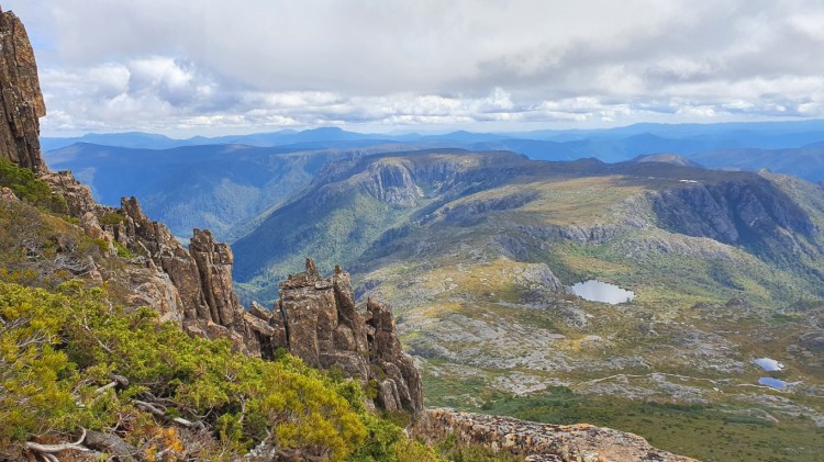
The scenery from the Cradle Mountain 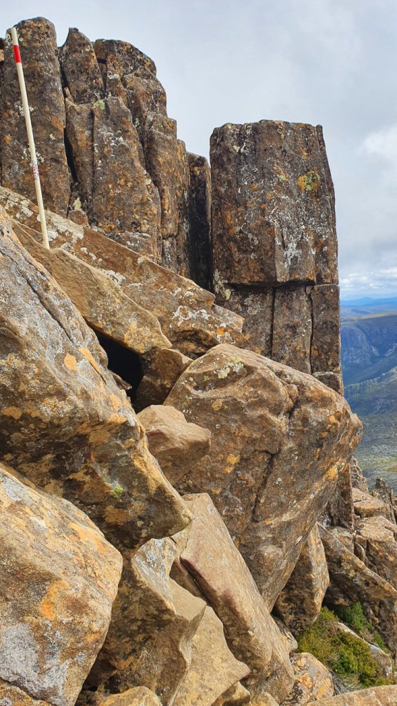
The path continued to up left there, but I turned around here.
After taking a break admiring the scenery, I started my way down. As it’s more boring to backtrack the same path, I turned at the intersection to the Face Track, which as the name implies, hugged the face of the mountain. It contained some uphill sections and as in the Visitor Center they said that there have been usually sightings of snakes in this section, I had to be careful always when I took hold with my hands when climbing. I originally planned to go back by the other side of Dove Lake along the mountain peaks, but as I had time constraints and also my legs were feeling all the climbing and hiking, I decided to turn left to have a shorter way back and fewer uphills. Also, a sign in that intersection said that the endpoint was two hours away and that was the time I had left at that point.
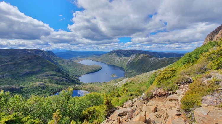
View of the Lake Wilks and the Dove Lake from the Face Track at Cradle Mountain Park
It started with a steep downhill bit with a chain-link to hold on while descending. After going by a smaller Lake Wilks, it finally reached the Dove Lake Circuit. It had a very lush forest section and one hill to cross before I finally reached the endpoint. In the end, I still had about 45 minutes before the last shuttle bus would have gone. But if I had gone all the way to the summit, time would have most likely run out. The hike took almost 5,5 hours with 818m of elevation gain over an 11,7 km long track. On the way to the Visitor Center, at the place where I started the hike, I saw a wombat nearby, but as I was on the shuttle bus, I couldn’t take a good photo of it.
I had about 1,5 hours of driving to do and I thought I have plenty of time before the deadline of the check-in in my next accommodation. I stopped at one scenic lookout viewing the Cradle Mountain from a distance and then another stop to eat. It was a tavern in a small town and as I walked in, I was the only customer there. It took a surprisingly long time to get my food and I started to feel the time pressure. Two times in one day when I had a deadline I didn’t want to miss. After I ate quickly I hopped in the car and the navigation estimated that I would be there less than ten minutes before the check-in closed, so there wasn’t much leeway there. The road was another twisty one but I finally arrived at my accommodation with about 5 minutes to spare.
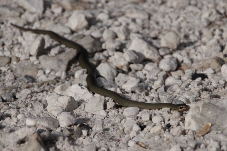
Small snake spotted in gravel road near a scenic lookout. So far the only snake in nature I have spotted in Australia.
The accommodation was another extraordinary one, which had the listing title in Airbnb as “Romantic glamping for two”. Firstly it was just for me and secondly glamping? When I was finding the accommodation, I had to research that what glamping is. It’s a combination of glamorous and camping. In practice, it was a big tent with a normal double bed inside it. In front of it, there was a fireplace and of course, after settling in, I put a fire in that and opened a relaxing beer. Keeping the fire lit ended up being a struggle as bigger logs were too big or just damp inside. After the beer, I gave up on the fire, so I put it out and logged out for the day.
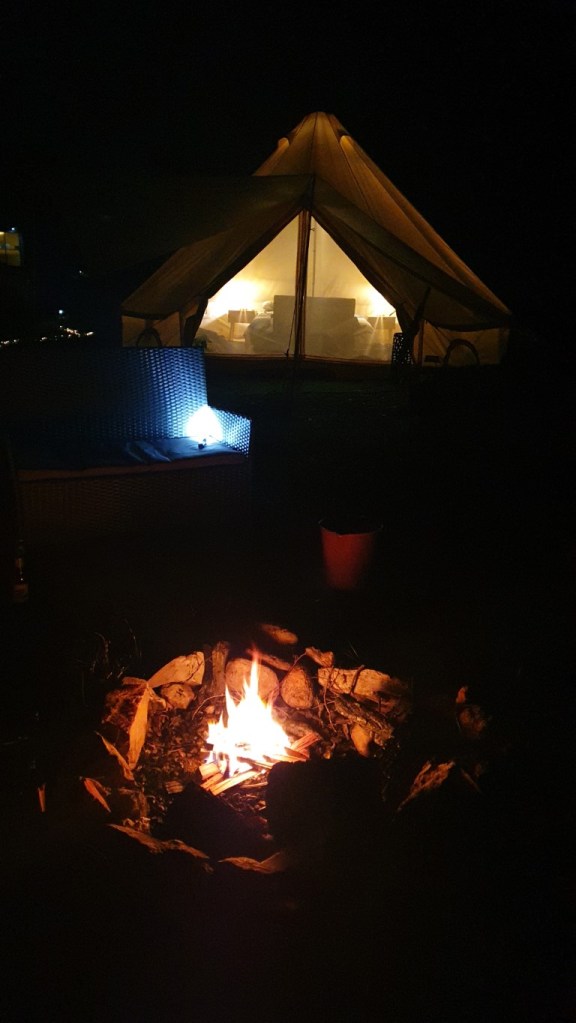
The fire when it was still decent with the tent in the background. 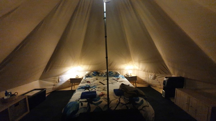
Inside of the glamping tent
Day 6
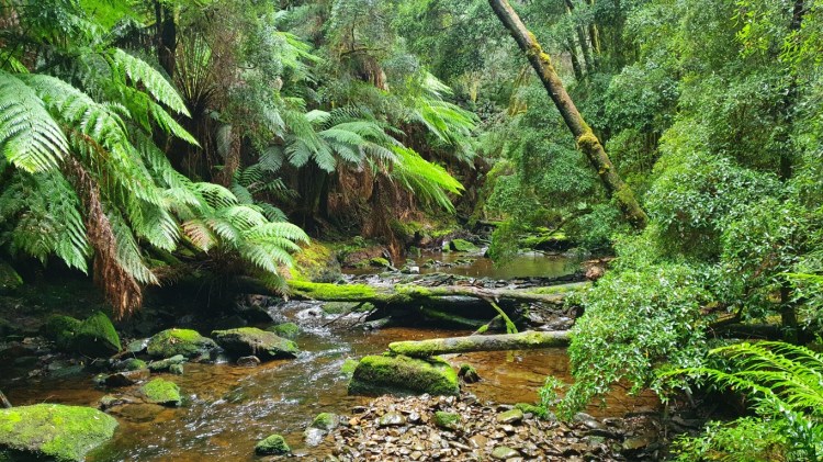
During the night I woke up at some point to the sound of rain against the roof of the tent. I knew that the next day will be a rainy one, but I didn’t have any must places or hikes to do. So I was quite lucky that the weather on the previous day was very good for hiking. All the driving and outdoor activities started to wear me down, so I didn’t mind a lighter day. I drove to a coastal town to have breakfast where I had planned of maybe renting a kayak, but the forecast changed that plan. I only visited one waterfall there I hadn’t planned on as it wasn’t raining in the morning.
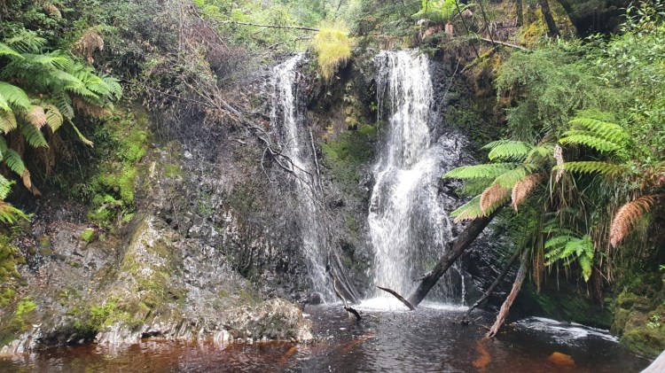
Hogart Falls near Strahan
I had a couple of spots near the next town of Queenstown that I was planning to visit. The weather was relatively good at this point but when I started climbing out of the valley where Queenstown was, I was heading into a cloud. Sure enough, those two spots were on top of that hill and after waiting a bit in the car in the car park looking at the heavy rain with a very fierce wind, I tried to venture toward a waterfall viewing point. I managed to walk against the wind and rain maybe a hundred meters when I turned back to the car. It wasn’t worth the effort and wet clothes.
I did stop at another falls after coming down from that hill. Under the umbrella, I walked the nature trail hopping over puddles to check out the falls. It was a nice walk to have a break from the driving. In the next bit of driving on a twisty forest road, I again started to feel tired, so I decided to stop at the next café or restaurant to eat and drink some coffee.
The stream coming from Nelson Falls 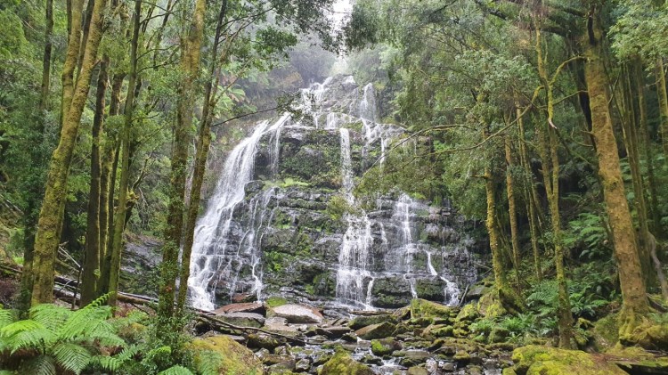
The Nelson Falls
There was one more waterfall I had planned to stop at, but I ended up not finding the car park for it. And as I hadn’t had internet on my phone after leaving the accommodation, I couldn’t check the instructions for it. Then I just drove to my next accommodation for the last night of this trip.
Day 7
For the last day, I had only Hobart to check out. First I went to the Royal Tasmanian Botanical Garden, which was a nice park again with plants, trees, and flowers from different places of the world. In a Japan Garden, there were a group of ducklings who were just following people in their feet and their mother nowhere to be seen. Hopefully, that story didn’t have an unhappy ending.
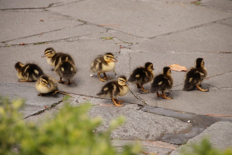
The ducklings that had lost their mom. 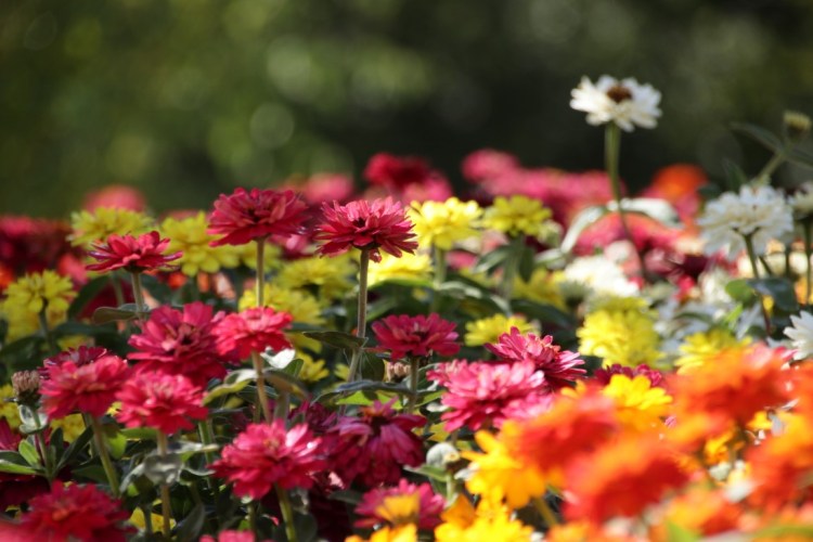
A flower bed at Hobart Botanical Garden
Another place I had selected to check out was Mount Wellington, which rises to 1271 meters from sea level just next to the city. This time I didn’t hike to the summit as there is a road leading up there. For the whole time while in Hobart I saw that the summit is covered in clouds, so there was a high chance that I wouldn’t see much there, but I wanted to test out my luck. As I drove up the twisty and narrow road, the temperature started dropping and when I reached the top within the clouds, the car temperature showed a whopping 3°C. The rain also had some sleet-like droplets, so it wasn’t far from getting slippery up there. I walked a bit up there but didn’t want to stay and just hope that the clouds would clear out and it was a bit chilly up there. After finding my way back into the city, I parked the car and after walking around there and ate a great Nepalese lunch. Then it was time to head back to the airport to return the car and get ready for the flight back to Melbourne.
The grand view from the top of Mount Wellington
During my week in Tasmania, I was quite fortunate with the weather and Tasmania has some great nature to see. I ended up driving almost exactly 1000 miles or 1600 km during the week. But now as I’m writing this post, I have already booked my next trip. So it won’t be long before again new adventures calls. It will be more of the tropical side of Australia in the state of Queensland with fewer self-guided hikes and more guided trips.
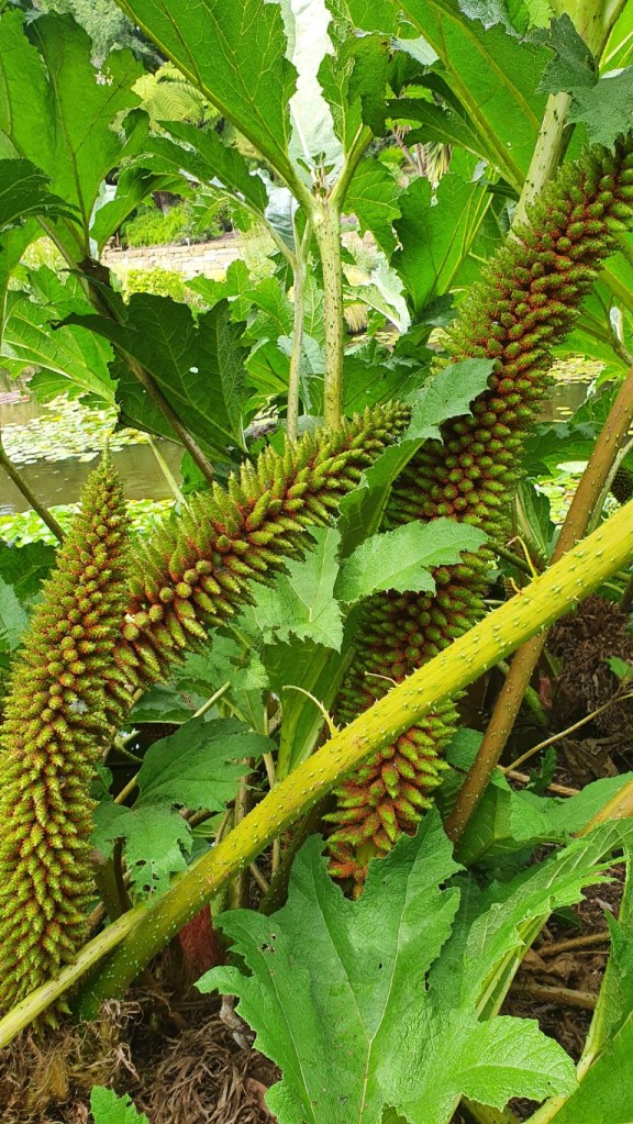
The Giant Rhubart at Hobart Botanical Garden 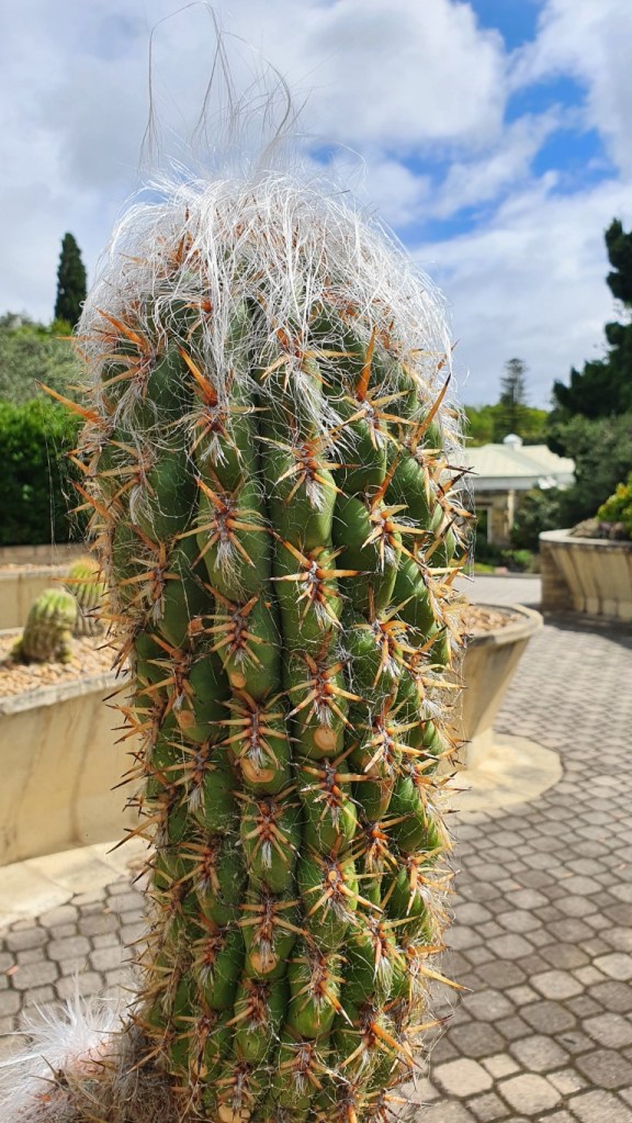
Old cactus with a bad hair day at Hobart Botanical Garden 
Some flowers in the garden of the B&B place 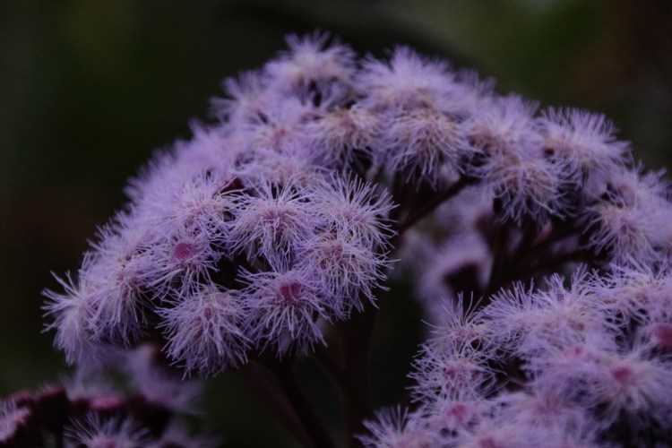
Some flowers in the garden of the B&B place 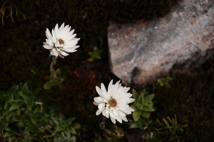
Mountain flowers near Cradle Mountain 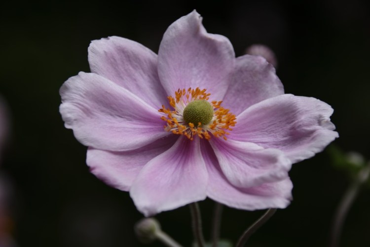
One of the flowers at Hobart Botanical Garden 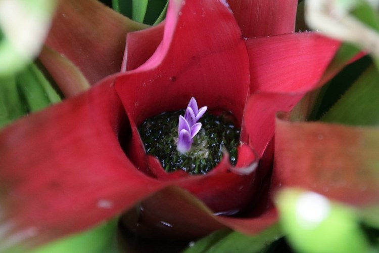
Almost like a flower within a flower in Hobart Botanical Garden
